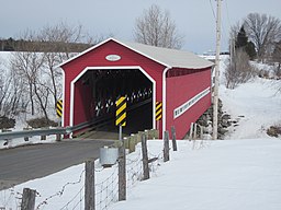
Rivière des Envies
| Rivière des Envies, La Mauricie, QC | |
| River | |
| Country | |
|---|---|
| Tributaries | |
| - left |
Discharge of lakes aux chicots and Croche (Sainte-Thècle), "Le Bourdais" River, Creek "Des Fous" |
| - right |
Little Mékinac North River (French: "Rivière Petite Mékinac du Nord"), Rivière à la tortue (Turtle River) |
| Cities | Saint-Stanislas (Les Chenaux), Saint-Séverin, Saint-Tite, Sainte-Thècle |
| Source | Discharge of Lake Traverse |
| - location | Sainte-Thècle, Mauricie, Province of Québec, Canada |
| - elevation | 165 m (541 ft) |
| - coordinates | 46°50′53″N 72°32′02″W / 46.84806°N 72.53389°W |
| Mouth | Saint-Stanislas (Les Chenaux) |
| - location | Quebec, Batiscanie, Canada |
| - coordinates | 46°50′53″N 72°24′00″W / 46.84806°N 72.40000°WCoordinates: 46°50′53″N 72°24′00″W / 46.84806°N 72.40000°W |
| Length | 74 km (46 mi) |
| Basin | 482 km2 (186 sq mi) |
Rivière des Envies (River of cravings, in a direct translation) is located in Canada, in the province of Quebec, in the Mauricie administrative region, in the Batiscanie. Rivière des Envies course 74 kilometres (46 mi) from the outlet of Lac-de-la-Traverse, located in row St-Joseph, Sainte-Thècle. This lake is fed by the outlet of Lake Aylwin, which in turn is fed by the discharge of Lake Jesuit (and lakes of surrounding mountains).
The watershed of the rivière des envies is 482 square kilometres (186 sq mi), i.e. the second largest watershed of Batiscanie. The basin is shared by three regional county municipalities:
• MRC of Mékinac (for Sainte-Thècle, Saint-Tite, Hérouxville and Saint-Séverin),
• MRC of Shawinigan (for Lac-à-la-Tortue),
• MRC des Chenaux (for Saint-Stanislas (Les Chenaux)).
Although the territory of the municipality of Saint-Adelphe is in the center of the arc formed by the course of the "River des Envies", this place is excluded from this watershed but a little area at the south-west—at the boundary with Saint-Stanislas (Les Chenaux).
The water of the river flows through municipalities of Sainte-Thècle, Saint-Tite, the boundary east of Hérouxville (about 4 km, along Row South, between the road Paquin and the road Lefebvre), Saint-Séverin and Saint-Stanislas (Les Chenaux). The river empties in Batiscan river at the southern edge of the village of Saint-Stanislas (Les Chenaux). The course of the river is especially cravings in agriculture. The river runs through a forest especially between Sainte-Thècle and Saint-Tite; downstream from Saint-Tite, the river passes through a few small areas of forest. The river also passes through the villages of Saint-Tite, Saint-Séverin and Saint-Stanislas (Les Chenaux).
...
Wikipedia

