Riverdale, Georgia
| Riverdale, Georgia | |
|---|---|
| City | |

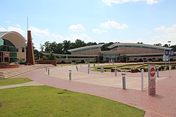
Riverdale Town Center
|
|
| Motto: Building Greatness Daily | |
 Location in Clayton County and the state of Georgia |
|
| Coordinates: 33°33′53″N 84°24′38″W / 33.56472°N 84.41056°WCoordinates: 33°33′53″N 84°24′38″W / 33.56472°N 84.41056°W | |
| Country | United States |
| State | Georgia |
| County | Clayton |
| Area | |
| • Total | 4.54 sq mi (11.76 km2) |
| • Land | 4.53 sq mi (11.74 km2) |
| • Water | 0.01 sq mi (0.03 km2) |
| Elevation | 925 ft (282 m) |
| Population (2010) | |
| • Total | 15,134 |
| • Density | 3,339/sq mi (1,289.3/km2) |
| Time zone | Eastern (EST) (UTC-5) |
| • Summer (DST) | EDT (UTC-4) |
| ZIP codes | 30274, 30296 |
| Area code(s) | 770/678/470 |
| FIPS code | 13-65464 |
| GNIS feature ID | 0321635 |
| Website | www |
Riverdale is a city in Clayton County, Georgia, United States. The population was 15,134 at the 2010 census, up from 12,478 at the 2000 census. Riverdale is a suburb just south of Hartsfield–Jackson Atlanta International Airport and is part of the Atlanta metropolitan area.
The area now known as Riverdale was settled before the Civil War. In 1887, a railroad, built from Atlanta and Fort Valley, passed through Riverdale. Farmers in the area provided wood for the railroad. In turn, the farmers would get fertilizer. As the railroad grew, it needed more land. Mr. and Mrs. W. S. Rivers donated their land for the railroad to grow, and their land grew to become one of the railroad's main stops.
In 1908, the city was incorporated with the name Riverdale, named in honor of Mr. W.S. Rivers.
Riverdale is in western Clayton County, 12 miles (19 km) south of downtown Atlanta and 6 miles (10 km) northwest of Jonesboro, the county seat.
According to the U.S. Census Bureau, Riverdale has an area of 4.5 square miles (11.6 km2), of which 0.012 square miles (0.03 km2), or 0.22%, is water.
As of the census of 2000, there were 12,478 people, 4,389 households, and 3,107 families residing in the city. The population density was 2,926.3 people per square mile (1,130.9/km²). There were 4,590 housing units at an average density of 1,076.4 per square mile (416.0/km²). The racial makeup of the city was 20.09% White, 67.42% African American, 0.30% Native American, 7.73% Asian, 0.08% Pacific Islander, 2.28% from other races, and 2.10% from two or more races. Hispanic or Latino of any race were 4.81% of the population.
...
Wikipedia
