Richmond, New Hampshire
| Richmond, New Hampshire | ||
|---|---|---|
| Town | ||

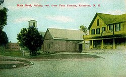
Fitzwilliam Road in 1911
|
||
|
||
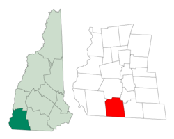
 Location in Cheshire County, New Hampshire |
||
| Coordinates: 42°45′17″N 72°16′18″W / 42.75472°N 72.27167°WCoordinates: 42°45′17″N 72°16′18″W / 42.75472°N 72.27167°W | ||
| Country | United States | |
| State | New Hampshire | |
| County | Cheshire | |
| Incorporated | 1752 | |
| Government | ||
| • Board of Selectmen | Christin Daugherty, Chair Kathryn McWhirk Carol Jameson |
|
| Area | ||
| • Total | 37.8 sq mi (97.8 km2) | |
| • Land | 37.6 sq mi (97.3 km2) | |
| • Water | 0.2 sq mi (0.5 km2) 0.53% | |
| Elevation | 1,063 ft (324 m) | |
| Population (2010) | ||
| • Total | 1,155 | |
| • Density | 31/sq mi (12/km2) | |
| Time zone | Eastern (UTC-5) | |
| • Summer (DST) | Eastern (UTC-4) | |
| ZIP code | 03470 | |
| Area code(s) | 603 | |
| FIPS code | 33-64420 | |
| GNIS feature ID | 0873706 | |
| Website | www |
|
Richmond is a town in Cheshire County, New Hampshire, United States. The population was 1,155 at the 2010 census.
The town was first chartered in 1735 by Governor Jonathan Belcher of Massachusetts. Granted to soldiers returning from the war in Canada, it was named Sylvester-Canada in honor of Captain Joseph Sylvester of Scituate, Massachusetts, who was killed in 1690 during an attempt to capture Quebec. After the border between Massachusetts and New Hampshire was fixed, the town fell on the New Hampshire side of the line. It was incorporated in 1752 as Richmond by Governor Benning Wentworth. He named it after Charles Lennox, 3rd Duke of Richmond, a staunch advocate of colonial independence. It was settled about 1757 by emigrants from Rhode Island and Massachusetts.
According to the United States Census Bureau, the town has a total area of 37.8 square miles (98 km2), of which 37.6 sq mi (97 km2) is land and 0.2 sq mi (0.52 km2) is water, comprising 0.53% of the town. Little Monadnock Mountain, elevation 1,883 feet (574 m) above sea level, is within a mile of the eastern boundary, in the town of Fitzwilliam. The highest point in Richmond is one mile northwest of Little Monadnock, on an unnamed hill whose elevation is 1,624 feet (495 m) above sea level. The Franconia Mountain Range (not to be confused with the much higher ridge in the White Mountains to the north) is a 1,300-foot (400 m) high chain of hills in the western part of town.
...
Wikipedia

