Scituate, Massachusetts
| Scituate, Massachusetts | ||
|---|---|---|
| Town | ||

Scituate Harbor
|
||
|
||
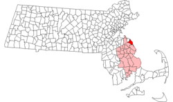
 Location in Plymouth County in Massachusetts |
||
| Coordinates: 42°11′45″N 70°43′35″W / 42.19583°N 70.72639°WCoordinates: 42°11′45″N 70°43′35″W / 42.19583°N 70.72639°W | ||
| Country | United States | |
| State | Massachusetts | |
| County | Plymouth | |
| Settled | 1630 | |
| Incorporated | 1636 | |
| Government | ||
| • Type | Open town meeting | |
| Area | ||
| • Total | 31.8 sq mi (82.4 km2) | |
| • Land | 17.6 sq mi (45.7 km2) | |
| • Water | 14.2 sq mi (36.8 km2) | |
| Elevation | 30 ft (9 m) | |
| Population (2010) | ||
| • Total | 18,133 | |
| • Density | 1,046/sq mi (404/km2) | |
| Time zone | Eastern (UTC-5) | |
| • Summer (DST) | Eastern (UTC-4) | |
| ZIP code | 02066 | |
| Area code(s) | 339 / 781 | |
| FIPS code | 25-60330 | |
| GNIS feature ID | 0618352 | |
| Website | www |
|
Scituate (![]() i/ˈsɪtʃuᵻt/) is a seacoast town in Plymouth County, Massachusetts, United States, on the South Shore, midway between Boston and Plymouth. The population was 18,133 at the 2010 census.
i/ˈsɪtʃuᵻt/) is a seacoast town in Plymouth County, Massachusetts, United States, on the South Shore, midway between Boston and Plymouth. The population was 18,133 at the 2010 census.
For geographic and demographic information on the village of North Scituate, which is a part of Scituate, please see the article North Scituate, Massachusetts.
Scituate was settled by a group of people from Plymouth about 1627, who were joined by immigrants from the county of Kent in England. They were initially governed by the General Court of Plymouth, but on October 5, 1636, the town incorporated as a separate entity. The name Scituate is derived from "satuit", the Wampanoag term for cold brook, which refers to a brook that runs to the inner harbor of the town. In 1710, several residents emigrated to Rhode Island and founded Scituate, Rhode Island, naming it after their previous hometown.
...
Wikipedia

