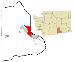
Richland, Washington
| Richland, Washington | ||
|---|---|---|
| City | ||
 |
||
|
||
| Nickname(s): The Windy City, City Of the Bombers, Atomic City | ||
 Location of Richland, Washington |
||
| Coordinates: 46°16′47″N 119°16′53″W / 46.27972°N 119.28139°W | ||
| Country | United States | |
| State | Washington | |
| County | Benton | |
| Government | ||
| • Type | Council–manager government | |
| • Mayor | David W. Rose | |
| • Mayor Pro Tem | Phillip Lemley | |
| Area | ||
| • City | 39.11 sq mi (101.29 km2) | |
| • Land | 35.72 sq mi (92.51 km2) | |
| • Water | 3.39 sq mi (8.78 km2) | |
| Elevation | 384 ft (117 m) | |
| Population (2010) | ||
| • City | 48,058 | |
| • Estimate (2015) | 54,248 | |
| • Rank | US: 692nd | |
| • Density | 1,345.4/sq mi (519.5/km2) | |
| • Metro | 279,116 (US: 169th) | |
| Time zone | Pacific (PST) (UTC-8) | |
| • Summer (DST) | PDT (UTC-7) | |
| ZIP codes | 99352, 99353, 99354 | |
| Area code(s) | 509 | |
| FIPS code | 53-58235 | |
| GNIS feature ID | 1513395 | |
| Website | www.ci.richland.wa.us | |
Richland is a city in Benton County in the southeastern part of the State of Washington, at the confluence of the Yakima and the Columbia Rivers. As of the 2010 census, the city's population was 48,058. April 1, 2013, estimates from the Washington State Office of Financial Management put the city's population at 51,150. Along with the nearby cities of Pasco and Kennewick, Richland is one of the Tri-Cities, Washington, and is home to the Hanford nuclear site.
For centuries, the village of Chemna stood at the mouth of the current Yakima River. Today that village site is called Columbia Point. From this village, the Wanapum, Yakama and Walla Walla Indians harvested the salmon runs entering the Yakima River. Captain William Clark of the Lewis and Clark Expedition visited the mouth of the Yakima River on October 17, 1805.
In 1904–1905, W.R. Amon and his son Howard purchased 2,300 acres (9 km2) and proposed a town site on the north bank of the Yakima River. Postal authorities approved the designation of this town site as Richland in 1905, naming it for Nelson Rich, a state legislator and land developer. In 1906, the town was registered at the Benton County Courthouse. It was incorporated on April 28, 1910, as a Washington Fourth Class City.
Richland was a small farm town until the U.S. Army purchased 640 sq mi (1,660 km2) of land – half the size of Rhode Island – along the Columbia River during World War II, evicting the 300 residents of Richland as well as those of the now vanished towns of White Bluffs and Hanford just upriver. The army turned it into a bedroom community for the workers on its Manhattan Project facility at the nearby Hanford Engineering Works (now the Hanford site). The population increased from 300 in July and August 1943 to 25,000 by the end of World War II in August 1945. All land and buildings were owned by the government. Housing was assigned to residents and token rent was collected; families were assigned to houses or duplexes; single people were placed in apartments or barracks. Everything necessary was provided, from free bus service to light bulbs, and trees were planted in people's yards by the government. In 1954 Harold Orlando Monson was elected the first mayor of Richland and traveled to Washington, D.C. to negotiate increased rights (such as private home ownership) for citizens in military cities across the country.
...
Wikipedia

