Richfield, MN
| Richfield, Minnesota | ||
|---|---|---|
| City | ||
|
||
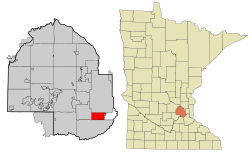
 Location of Richfield within Hennepin County, Minnesota |
||
| Coordinates: 44°52′55″N 93°16′06″W / 44.882026°N 93.268447°WCoordinates: 44°52′55″N 93°16′06″W / 44.882026°N 93.268447°W | ||
| Country | United States | |
| State | Minnesota | |
| County | Hennepin | |
| Founded | 1850s | |
| Incorporated | 1908 | |
| Government | ||
| • Mayor | Pat Elliot | |
| Area | ||
| • City | 7.01 sq mi (18.16 km2) | |
| • Land | 6.87 sq mi (17.79 km2) | |
| • Water | 0.14 sq mi (0.36 km2) 2.00% | |
| Elevation | 840 ft (256 m) | |
| Population (2010) | ||
| • City | 35,228 | |
| • Estimate (2015) | 36,216 | |
| • Density | 5,127.8/sq mi (1,979.9/km2) | |
| • Metro | 3,524,583 (US: 16th) | |
| Time zone | CST (UTC-6) | |
| • Summer (DST) | CDT (UTC-5) | |
| ZIP code | 55423 | |
| Area code(s) | 612 | |
| FIPS code | 27-54214 | |
| GNIS feature ID | 0650061 | |
| Website | www.cityofrichfield.org | |
Richfield is a city in Hennepin County, Minnesota, United States. An inner-ring suburb of the Minneapolis–Saint Paul region, it is bordered by Minneapolis to the north, Minneapolis–Saint Paul International Airport to the east, Bloomington to the south, and Edina to the west. Best Buy, the U.S.'s largest electronics retailer, has its headquarters in Richfield. The population was 35,228 at the 2010 census.
The beginnings of Richfield date back to the 1850s, when it was still a small farming community. Close to Minneapolis and Fort Snelling, it was on the edge of a growing and expanding city with business and commerce not far away. One of the first settlers was Riley Bartholomew, a former General in the Ohio Militia who became a Richfield Justice of the Peace and a Minnesota State Senator. Bartholomew built a house on the east shore of Wood Lake in 1852, and the restored Riley Lucas Bartholomew House is listed on the National Register of Historic Places. Today, the house and site are maintained by the Richfield Historical Society. In the early days, Richfield extended as far north as Lake Street, and included present day Edina and parts of St. Louis Park and Hopkins on the west, and extended to the Mississippi and the Minnesota Rivers on the east, and to Bloomington on the south. On May 11, 1858, as Congress was admitting Minnesota into the Union, the early residents of Richfield had their first town meeting. That same year Richfield was named for the fertile farm land it encompassed. By 1879, the community's first town hall was constructed. Early residents were German, Irish and families from the New England area. These residents were soon joined by immigrants from Sweden, Norway and Denmark.
...
Wikipedia

