Rich Creek, VA
| Rich Creek, Virginia | |
|---|---|
| Town | |
| Coordinates: 37°23′2″N 80°49′19″W / 37.38389°N 80.82194°WCoordinates: 37°23′2″N 80°49′19″W / 37.38389°N 80.82194°W | |
| Country | United States |
| State | Virginia |
| County | Giles |
| Area | |
| • Total | 0.85 sq mi (2.20 km2) |
| • Land | 0.83 sq mi (2.15 km2) |
| • Water | 0.02 sq mi (0.05 km2) |
| Elevation | 1,532 ft (467 m) |
| Population (2010) | |
| • Total | 774 |
| • Density | 934/sq mi (360.5/km2) |
| Time zone | Eastern (EST) (UTC-5) |
| • Summer (DST) | EDT (UTC-4) |
| ZIP code | 24147 |
| Area code(s) | 540 |
| FIPS code | 51-66896 |
| GNIS feature ID | 1497138 |
| Website | www |
Rich Creek is a town in Giles County, Virginia, United States. The population was 774 at the 2010 census, up from 665 at the 2000 census. It is part of the Blacksburg–Christiansburg–Radford Metropolitan Statistical Area.
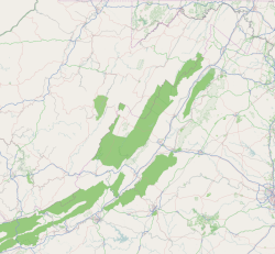
Rich Creek is located in northwestern Giles County at 37°23′2″N 80°49′19″W / 37.38389°N 80.82194°W (37.383960, -80.821818), on the east side of the New River at the mouth of Rich Creek. U.S. Route 460 passes through the town, leading south (upriver) 4 miles (6 km) to Narrows and west (downriver) 3.5 miles (5.6 km) to Glen Lyn. Pearisburg is 9 miles (14 km) southeast of Rich Creek (upriver).
U.S. Route 219 has its southwestern terminus at US 460 in Rich Creek. It leads northeast 2 miles (3 km) to Peterstown, West Virginia, and ultimately 535 miles (861 km) to West Seneca, New York, near Buffalo.
...
Wikipedia


