Ribeira Grande de Santiago (stream)
| Ribeira Grande de Santiago | |
|---|---|

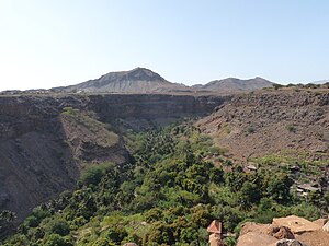
The valley of Ribeira Grande de Santiago
|
|
| Country | Cape Verde |
| Basin features | |
| Main source | southwest of São Domingos Santiago Island, Cape Verde 750 m (2,460 ft) |
| River mouth |
Cidade Velha 14°54′51″N 22°36′19″W / 14.9142°N 22.6054°W |
| Physical characteristics | |
| Length | 15 km (9.3 mi) |
Ribeira Grande de Santiago (Portuguese for a large stream) is a stream that flows in the southern part of the island of Santo Antão in Cape Verde, the upper portion is called Ribeira Cadacina. The stream flows south with one exception in the area of the municipal boundaries and is about 14 to 15 km in length, there are no tributaries but one in the area of Calabaceira. During dry days especially in the Spring and Summer, the stream is predominantly dry.
The stream as Ribeira Cadacina starts from the agricultural and mountainous portion of the south of the island around Achada Louro (or Massapé) in the municipality of São Domingos inside the boundaries of Pico da Antónia Natural Park. The road (EN3-ST07) linking Ribeira Grande with Rui Vaz and São Domingos runs within the left bank of the river, the road serves Ribeira Grande with the middle and the north of the island. It flows east of Monte Redondos (652 meters) at an altitiude of 540 meters, the municipal boundary at around 450 meters, the village of Achada Louro, the Salineiro Reservoir at 260 meters where the stream continues as Ribeira Grande de Santiago and at about 250 meters at the dam. At 209 meters, plantations starts to appear particularly baobabs, cocoa, sugar and mangoes grown for centuries, there the river steeps a bit town where it is 140 meters near Salineiro where there area two bends and 100 meters west of Calabaceira, it enters the Cidade Velha urban area at 40 meters and has a right bend, at 20 meters, nearby is Fort Real de São Filipe, it crosses Rua Calhau, a road linking Praia and Porto Mosquito at 3 meters and empties into the Atlantic just south. For a kilometer, a street named after the river runs on the river.
Fort Real de São Filipe a World Heritage Site has several forts in the area, the first three fortresses, Forte de Santo António, Forte de São João dos Cavaleiros and Forte de São Veríssimo are on the left bank and Forte de São Bras, a east-west lined fortress on the right bank
Most notable is that much of the grogue grown are of the plantations of the valley of Ribeira Grande de Santiago. Distillation plants are located along the stream in Salineiro and mostly in Cidade Velha.
...
Wikipedia
