Rexburg, Idaho
| Rexburg, Idaho | |
|---|---|
| City | |

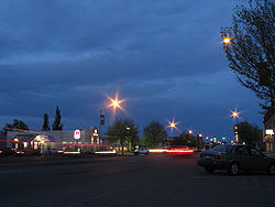
Downtown Rexburg, May 2007
|
|
| Motto: "America's Family Community" | |
 Location of Rexburg, Idaho |
|
| Location in the United States | |
| Coordinates: 43°49′N 111°47′W / 43.817°N 111.783°WCoordinates: 43°49′N 111°47′W / 43.817°N 111.783°W | |
| Country | United States |
| State | Idaho |
| County | Madison |
| Area | |
| • Total | 9.84 sq mi (25.49 km2) |
| • Land | 9.76 sq mi (25.28 km2) |
| • Water | 0.08 sq mi (0.21 km2) |
| Elevation | 4,865 ft (1,483 m) |
| Population (2010) | |
| • Total | 25,484 |
| • Estimate (2012) | 25,732 |
| • Density | 2,611.1/sq mi (1,008.2/km2) |
| Time zone | Mountain (MST) (UTC-7) |
| • Summer (DST) | MDT (UTC-6) |
| ZIP codes | 83440, 83441, 83460 |
| Area code(s) | 208 |
| FIPS code | 16-67420 |
| GNIS feature ID | 0374648 |
| Website | City of Rexburg, Idaho Website |
Rexburg is a city in Madison County, Idaho, United States. The population was 25,484 at the 2010 census, up from 17,257 in 2000. The city is the county seat of Madison County and its largest city. Rexburg is the principal city of the Rexburg, ID Micropolitan Statistical Area, which includes Fremont and Madison Counties. The city is home to Brigham Young University-Idaho (BYU-Idaho), a private institution operated by The Church of Jesus Christ of Latter-day Saints (LDS Church).
The city takes its name from Ricks, the German form of which is "Rex", after founder Thomas Edwin Ricks. The city was incorporated in 1883.
Rexburg was severely damaged by the Teton Dam Flood in June 1976. The Teton River flowed through northern Rexburg, and left most of the city underwater for several days after the Teton Dam ruptured. A museum dedicated to the Teton Dam Flood and the history of Rexburg and the area, located in the basement of the Rexburg Tabernacle, has been a major city landmark for decades.
When the Rexburg Idaho Temple was dedicated in 2008, Rexburg became the third city in Idaho with an LDS temple.
Rexburg is located at 43°49′N 111°47′W / 43.817°N 111.783°W, at an elevation of 4,865 feet (1,483 m) above sea level.
...
Wikipedia

