Teton Dam
| Teton Dam | |
|---|---|

Catastrophic failure on June 5, 1976
|
|
|
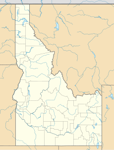
Location in eastern Idaho
|
|
| Official name | Teton Dam |
| Country | United States |
| Location | Fremont & Madison counties, Idaho |
| Coordinates | 43°54′35″N 111°32′21″W / 43.90972°N 111.53917°WCoordinates: 43°54′35″N 111°32′21″W / 43.90972°N 111.53917°W |
| Purpose | Flood control, irrigation |
| Construction began | 1972 |
| Opening date | 1976 |
| Demolition date | June 5, 1976 (failure) |
| Construction cost | $48,825,000 |
| Owner(s) | U.S. Bureau of Reclamation |
| Dam and spillways | |
| Type of dam | Embankment dam |
| Impounds | Teton River |
| Height | 305 ft (93 m) |
| Length | 3,100 ft (940 m) |
| Width (base) | 1,700 ft (520 m) |
| Reservoir | |
| Creates | Teton Reservoir |
| Total capacity | 288,250 acre feet (355,550,000 m3) |
| Normal elevation | 5,320 ft (1,620 m) AMSL |
The Teton Dam was an earthen dam on the Teton River in Idaho, United States. It was built by the Bureau of Reclamation, one of eight federal agencies authorized to construct dams. Located in the eastern part of the state, between Fremont and Madison counties, it suffered a catastrophic failure on June 5, 1976, as it was filling for the first time.
The collapse of the dam resulted in the deaths of 11 people and 13,000 cattle. The dam cost about $100 million to build, and the federal government paid over $300 million in claims related to its failure. Total damage estimates have ranged up to $2 billion. The dam has not been rebuilt.
There had been interest in building a dam in the eastern Snake River Plain for many years to control spring runoff and provide a more constant water supply in the summer. The area had suffered a severe drought in 1961, followed by serious flooding in 1962. The Bureau of Reclamation (USBR) proposed the Teton Dam in 1963, and Congress passed without opposition an authorizing bill the following year. The planned dam was to be an earthen structure 310 feet (94 m) high and 0.6 miles (1.0 km) long and create a reservoir 17 miles (27 km) in length. The impounded water would be used to generate hydroelectric power. An environmental impact statement was issued for the dam in 1971, but it did not raise the possibility of a collapse.
The primary contractor for the dam was Morrison-Knudsen Co. of Boise, assisted by Peter Kiewit Sons Co. of Omaha, Nebraska. The $39 million contract was awarded in December 1971 and work began in 1972.
...
Wikipedia

