Renkum
| Renkum | |||
|---|---|---|---|
| Municipality | |||

Renkum town hall
|
|||
|
|||
 Location in Gelderland |
|||
| Coordinates: 51°59′N 5°51′E / 51.983°N 5.850°ECoordinates: 51°59′N 5°51′E / 51.983°N 5.850°E | |||
| Country | Netherlands | ||
| Province | Gelderland | ||
| Government | |||
| • Body | Municipal council | ||
| • Mayor | vacant | ||
| Area | |||
| • Total | 47.23 km2 (18.24 sq mi) | ||
| • Land | 46.01 km2 (17.76 sq mi) | ||
| • Water | 1.22 km2 (0.47 sq mi) | ||
| Elevation | 51 m (167 ft) | ||
| Population (February 2017) | |||
| • Total | 31,494 | ||
| • Density | 685/km2 (1,770/sq mi) | ||
| Demonym(s) | Renkumer | ||
| Time zone | CET (UTC+1) | ||
| • Summer (DST) | CEST (UTC+2) | ||
| Postcode | 6860–6874 | ||
| Area code | 026, 0317 | ||
| Website | www |
||
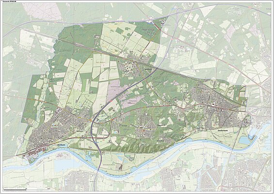
Renkum (![]() pronunciation ) is a municipality and a town in the eastern Netherlands. The municipality had a population of 31,494 in 2017 and has a land area of 46.01 km2 (17.76 sq mi). Renkum is situated along the river Rhine. The municipality Renkum is part of the Stadsregio (English: City region) Arnhem-Nijmegen.
pronunciation ) is a municipality and a town in the eastern Netherlands. The municipality had a population of 31,494 in 2017 and has a land area of 46.01 km2 (17.76 sq mi). Renkum is situated along the river Rhine. The municipality Renkum is part of the Stadsregio (English: City region) Arnhem-Nijmegen.
The surrounding of the municipality are mainly forest and river forelands. In the forest one can find tumulus of thousand years old. Findings from these tumulus can be seen in the Historic museum in Arnhem.
Renkum is more than thousand years old. In 1970 the thousand-year anniversary was celebrated. In the early days, the name was written as Redinchem. In the 19th century Renkum developed itself. There existed six paper mills, three water-cornmills and one water-oil mill. There were two factories, a treacle factory and a potato starch-flour factory. There was also a beer brewery and a tavern de Bok.
Nowadays there is still paper industry The company is Parenco B.V., acquired by H2 Equity Partners in 2012.
...
Wikipedia


