Rendsburg High Bridge
|
Rendsburg High Bridge Rendsburger Hochbrücke |
|
|---|---|

Main span of the Rendsburg High Bridge
|
|
| Coordinates | 54°17′36.94″N 9°40′58.45″E / 54.2935944°N 9.6829028°ECoordinates: 54°17′36.94″N 9°40′58.45″E / 54.2935944°N 9.6829028°E |
| Crosses | Kiel Canal |
| Locale | Rendsburg, Germany |
| Official name | Eisenbahnhochbrücke Rendsburg |
| Characteristics | |
| Design | Cantilever bridge |
| Material | Steel |
| Total length | 2,486 metres (8,156 ft) |
| Height | 68 metres (223 ft) |
| Longest span | 140 metres (460 ft) |
| Piers in water | None |
| Clearance above | 42 metres (138 ft) |
| History | |
| Designer | Friedrich Voss |
| Construction begin | 1911 |
| Construction end | 1913 |
 |
|
The Rendsburg High Bridge (German: Rendsburger Hochbrücke, officially Eisenbahnhochbrücke Rendsburg) is a railway viaduct on the Neumünster–Flensburg line that also serves as a transporter bridge. The bridge crosses the Kiel Canal at Rendsburg in the German state of Schleswig-Holstein. It is federally owned through the Federal Water and Navigation Administration that also owns and runs the canal.
The Kiel Canal (then Kaiser-Wilhelm-Kanal) was built between 1887 and 1895 cutting through existing traffic lines including the railway line between Neumünster and Flensburg for which two parallel swing bridges were built. In 1907 it was decided to enlarge the canal and in the course of this expansion major obstacles were also to be removed.
Main railway lines had right of way over ships on the canal and ships had to stop, losing about half an hour when a train passed. This was considered the major obstacle as the ships were unable to overtake and could pass each other at dedicated enlarged areas so that the traffic on the entire canal was hampered. Especially the navy pressed for a separation of traffic flows as closed bridges could delay flotillas by several hours.
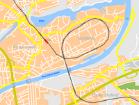
In order to allow the railway line to pass above the canal, the new bridge was to have a clearance of 42 metres over the canal's mean water level. The existing tracks crossed the canal about 7 metres above the canal's water level, so the tracks had to be elevated by about 36.5 metres including additional 1.5 metres to accommodate the thickness of the lower girder. The required maximum incline of 1:150 (one metre gain in altitude per 150 metres distance) made it necessary to build elevated embankments and access bridges of about 5.5 km at each side.
The bridge was erected between 1911 and 1913 to a design by Friedrich Voss (1872–1953) and replaced the earlier swing bridges.
...
Wikipedia
