Reißeck
| Reißeck | ||
|---|---|---|

Kolbnitz
|
||
|
||
| Location within Austria | ||
| Coordinates: 46°53′N 13°18′E / 46.883°N 13.300°ECoordinates: 46°53′N 13°18′E / 46.883°N 13.300°E | ||
| Country | Austria | |
| State | Carinthia | |
| District | Spittal an der Drau | |
| Government | ||
| • Mayor | Gerd Pichler | |
| Area | ||
| • Total | 139.83 km2 (53.99 sq mi) | |
| Elevation | 613 m (2,011 ft) | |
| Population (1 January 2016) | ||
| • Total | 2,199 | |
| • Density | 16/km2 (41/sq mi) | |
| Time zone | CET (UTC+1) | |
| • Summer (DST) | CEST (UTC+2) | |
| Postal codes | 9815, 9816 | |
| Area code | 04783 | |
| Website | www.reisseck.at | |
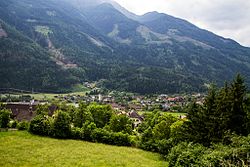
Reißeck is a municipality in the district of Spittal an der Drau in Carinthia, Austria.
Situated within the valley of the Möll river, a tributary to the Drava, Reißeck is located about 20 kilometres (12 mi) northwest of the district capital Spittal an der Drau. The present-day municipality established in 1973 consists of the four cadastral communities Kolbnitz, Zandlach, Penk, and Teuchl. It was named after the Reißeck massif (2,965m/9,727 ft) in the north, part of the Ankogel Group of the Hohe Tauern mountain range. South of the Möll valley rises the Kreuzeck Group.
Equidistant between the ski resorts of Ankogel/Mölltal Glacier and Lake Millstatt, facilities in Kolbnitz include a rafting centre, a riding centre, tennis courts, a small ski area and a swimming pool. Two funicular railway lines leave from the Möll valley bottom: the first runs up the Reißeck mountain to an altitude of 2236m/7336 ft to walking trails and a hotel; the second leads to the mountain rail station of Mt. Kreuzeck at 1211m/3973 ft, which is the starting point for several alpine walks up to 2498m/8195 ft. The operation of the Reißeck Höhenbahn on the Reißeck plateau, one of the highest-lying narrow-gauge railroads in Europe, was closed down in 2014.
Reißeck has access to the Tauern Railway line, running from Spittal an der Drau through the Tauern Railway Tunnel to Schwarzach im Pongau, at the Kolbnitz and Penk stations. It also can be reached via the parallel Mölltal Straße (B106) highway from Lurnfeld in the Drava valley up to Obervellach and Winklern.
...
Wikipedia


