Millstätter See
| Millstätter See Lake Millstatt |
|
|---|---|

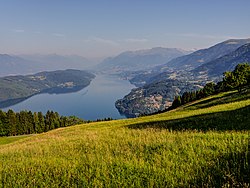
View from the east
|
|
 |
|
| Location | Carinthia |
| Coordinates | 46°47′42″N 13°34′47″E / 46.79500°N 13.57972°ECoordinates: 46°47′42″N 13°34′47″E / 46.79500°N 13.57972°E |
| Type | glacial lake |
| Primary inflows | Riegenbach |
| Primary outflows | Seebach to Lieser river |
| Catchment area | 285 km2 (110 sq mi) |
| Basin countries | Austria |
| Max. length | 12 km (7.5 mi) |
| Max. width | 1.8 km (1.1 mi) |
| Surface area | 13.3 km2 (5.1 sq mi) |
| Average depth | 89 m (292 ft) |
| Max. depth | 142 m (466 ft) |
| Water volume | 1.205 km3 (977,000 acre·ft) |
| Residence time | 7.5 years |
| Surface elevation | 588 m (1,929 ft) |
| Settlements | Seeboden, Millstatt, Döbriach |
Lake Millstatt (German: Millstätter See, sometimes written "Millstättersee") is a lake in Carinthia, Austria.
It is situated at 588 metres above the Adriatic (1,929 ft), north of the Drava Valley within the Gurktal Alps (Nock Mountains) range of the Central Eastern Alps, near the town of Spittal an der Drau. With a surface area of 13.3 km2 (5.1 sq mi) Lake Millstatt is the second largest lake of Carinthia (after Lake Wörth), though with a depth of 142 m (466 ft) the most voluminous by far.
Its steep shore gives the lake a fjord-like character. The Millstätter Alpe mountains in the north up to 2,100 m (6,900 ft) protect it from cold winds, so the water temperature can reach 25 °C (77 °F) in summer. The narrow and long surface stretches over 12 km (7.5 mi) from east to west. In the south the wooded Hochgosch plateau, with a breadth of 2 km (1.2 mi) and an elevation of 876 m (2,874 ft), divides the lake from the parallel Drava Valley.
The name derives from the market town Millstatt on the northern shore. Other municipalities near the lake are Seeboden and Radenthein-Döbriach. The shaded southern shore, a protected area since 1970, is almost uninhabited.
The lake arose in the last glacial (Würm) period, about 20,000 years ago, when a northern offset of the Drava glacier melted in situ and left dead-ice with extended fluvial deposits at its western rim damming meltwater. The continuous erosive downcutting by the discharge of the kettle into the Lieser River over the following millennia created a trench that considerably lowered the water level.
...
Wikipedia
