Red Bay, Alabama
| Red Bay, Alabama | |
|---|---|
| City | |
| Motto: "A friendly city on a progressive path" | |
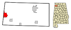
 Location in Franklin County and the state of Alabama |
|
| Coordinates: 34°26′24″N 88°8′18″W / 34.44000°N 88.13833°W | |
| Country | United States |
| State | Alabama |
| County | Franklin |
| Government | |
| • Type | Municipality |
| • Mayor | Charlene Fancher |
| Area | |
| • Total | 9.8 sq mi (25.5 km2) |
| • Land | 9.7 sq mi (25.2 km2) |
| • Water | 0.1 sq mi (0.3 km2) |
| Elevation | 643 ft (196 m) |
| Population (2010) | |
| • Total | 3,158 |
| • Density | 324/sq mi (125.1/km2) |
| Time zone | Central (CST) (UTC-6) |
| • Summer (DST) | CDT (UTC-5) |
| ZIP code | 35582 |
| Area code(s) | 256 |
| FIPS code | 01-63576 |
| GNIS feature ID | 0155213 |
| Website | www |
Red Bay is a city in Franklin County, Alabama, United States. It was founded in 1907. The population was 3,158 at the 2010 census, down from 3,374 at the 2000 census.
Red Bay is located in western Franklin County at 34°26′24″N 88°8′18″W / 34.44000°N 88.13833°W (34.439898, -88.138208). The western border of the city is the Mississippi state line. It is situated on the Tennessee Valley divide, with the northern half of the city draining north to Bear Creek, a tributary of the Tennessee River, and the southern half draining south to Gum Creek, a tributary of the Tombigbee River.
Alabama State Route 24 is a four-lane highway that passes south of the city center, leading east 25 miles (40 km) to Russellville and west 2 miles (3 km) to the Mississippi line. Tremont, Mississippi, is 18 miles (29 km) to the southwest.
According to the U.S. Census Bureau, the city has a total area of 9.8 square miles (25.5 km2), of which 9.7 square miles (25.2 km2) is land and 0.1 square miles (0.3 km2), or 1.01%, is water.
As of the census of 1990 the racial makeup of the city was 95.06% White, 3.25% Black or African American, 0.25% Native American, 0.62% from other races, and 0.91% from two or more races. 0.9% of the population were Hispanic or Latino of any race.
...
Wikipedia
