Rastatt
| Rastatt | ||
|---|---|---|
 |
||
|
||
| Coordinates: 48°51′N 8°12′E / 48.850°N 8.200°ECoordinates: 48°51′N 8°12′E / 48.850°N 8.200°E | ||
| Country | Germany | |
| State | Baden-Württemberg | |
| Admin. region | Karlsruhe | |
| District | Rastatt | |
| Government | ||
| • Mayor | Hans Jürgen Pütsch | |
| Area | ||
| • Total | 59.02 km2 (22.79 sq mi) | |
| Population (2015-12-31) | ||
| • Total | 48,051 | |
| • Density | 810/km2 (2,100/sq mi) | |
| Time zone | CET/CEST (UTC+1/+2) | |
| Postal codes | 76401-76437 | |
| Dialling codes | 07222, 07229 | |
| Vehicle registration | RA | |
| Website | rastatt.de | |
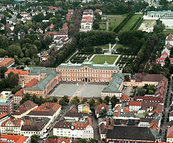
Rastatt (German: [ˈʁaʃtat]) is a town and baroque residence in the District of Rastatt, Baden-Württemberg, Germany. It is located in the Upper Rhine Plain on the Murg river, 6 km (3.7 mi) above its junction with the Rhine and has a population of around 50,000 (2011). Rastatt was an important place of the War of the Spanish Succession (Treaty of Rastatt) and the Revolutions of 1848 in the German states.
Until the end of the 17th century, Rastatt held little influence, but after its destruction by the French in 1689, it was rebuilt on a larger scale by Louis William, margrave of Baden, the imperial general in the Habsburg-Ottoman War known popularly as Türkenlouis.
It then remained the residence of the margraves of Baden-Baden until 1771. It was the location of the First and Second Congress of Rastatt, the former giving rise to the Treaty of Rastatt. In the 1840s, Rastatt was surrounded by fortifications to form the fortress of Rastatt. For about 20 years previous to 1866, it was occupied by the troops of the German Confederation.
...
Wikipedia


