Rangpo
| Rangpo | |
|---|---|
| town | |
| Coordinates: 27°10′30″N 88°31′48″E / 27.175°N 88.530°ECoordinates: 27°10′30″N 88°31′48″E / 27.175°N 88.530°E | |
| Country | India |
| State | Sikkim |
| District | East |
| Elevation | 333 m (1,093 ft) |
| Population (2001) | |
| • Total | 3,724 |
| Languages | |
| • Official | Nepali, Bhutia, Lepcha, Limbu, Newari, Rai, Gurung, Mangar, Sherpa, Tamang and Sunwar |
| Time zone | IST (UTC+5:30) |
| Vehicle registration | SK |
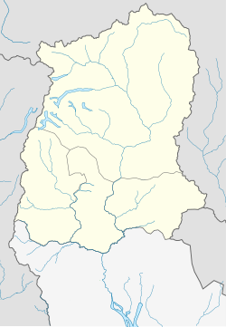
Rangpo (Nepali: रम्फु) is a town in East Sikkim in the Indian state of Sikkim. The town borders West Bengal and is situated along the Teesta river. It is the first town in Sikkim on NH 10 that links Siliguri to Gangtok. It is about 200 m above sea level with a sub-tropical climate. All vehicles entering Sikkim have to stop here. Foreign tourists require documents to enter Sikkim state and have to show them at the border police post.It is the Gateway to Sikkim.
Rangpo has a large population of Nepalis and Bhutias. Marwari and Bihari businessmen have settled in the town and own most of the shops among them are few old settlers in town who have history of business since 1912.
Rangpo is located at 27°11′N 88°32′E / 27.18°N 88.53°E. It has an average elevation of 333 metres (1093 feet).
As of 2001[update] India census, Rangpo had a population of 3,724. Males constitute 55% of the population and females 45%. Rangpo has an average literacy rate of 70%, higher than the national average of 59.5%: male literacy is 75%, and female literacy is 63%. In Rangpo, 13% of the population is under 6 years of age.
...
Wikipedia


