Siliguri
|
Siliguri শিলিগুড়ি सिलिगुडि |
||||||
|---|---|---|---|---|---|---|
| Metropolitan city | ||||||
Top to bottom :
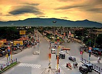
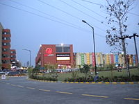
Old view of Siliguri, Lions Clock Tower, City Centre ,Cosmos Mall |
||||||
| Location of Siliguri in West Bengal | ||||||
| Coordinates: 26°43′N 88°26′E / 26.71°N 88.43°ECoordinates: 26°43′N 88°26′E / 26.71°N 88.43°E | ||||||
| Country |
|
|||||
| State | West Bengal | |||||
| District | Darjeeling (62%), Jalpaiguri (38%) | |||||
| Government | ||||||
| • Type | Municipal Corporation | |||||
| • Body | Siliguri Municipal Corporation | |||||
| • Mayor | Ashok Bhattacharya(CPI(M)) | |||||
| • ADM / SDO | Rajanvir Singh Kapur (IAS) | |||||
| Area | ||||||
| • Metropolitan city | 260 km2 (100 sq mi) | |||||
| • Metro | 2,327.12 km2 (898.51 sq mi) | |||||
| Area rank | 2nd in West Bengal, 1st in Northeast India | |||||
| Highest elevation | 140 m (460 ft) | |||||
| Lowest elevation | 114 m (374 ft) | |||||
| Population (2011 census) | ||||||
| • Metropolitan city | 705,579 | |||||
| • Rank | 3rd in West Bengal, 2nd in Northeast India | |||||
| • Density | 2,700/km2 (7,000/sq mi) | |||||
| • Metro | 1,057,438 | |||||
| Languages | ||||||
| • Official | Bengali, Nepali, Hindi, English | |||||
| Time zone | IST (UTC+5:30) | |||||
| PIN | 734 001-734 015 (city limits), 734 401-734 436, 735 133-735 135(suburbs) | |||||
| Telephone code | 0353, 0354, 03561 | |||||
| Vehicle registration | WB 71/72/73/74/76/772 | |||||
| Lok Sabha constituency | Darjeeling, Jalpaiguri | |||||
| Vidhan Sabha constituency | Siliguri, Dabgram-Phulbari, Matigara-Naxalbari | |||||
| Website |
www |
|||||
|
1The coordinates given here are in metric system and based upon the Microsoft Encarta Reference Library Map Center 2005 2 The Vehicle Code given here based upon the Siliguri Sub Divisional Court, Darjeeling District Court and Jalpaiguri District Court documentations. |
||||||
1The coordinates given here are in metric system and based upon the Microsoft Encarta Reference Library Map Center 2005
Siliguri (![]() pronunciation ) is a city which spans across the Darjeeling and Jalpaiguri districts in the Indian state of West Bengal. The city is located on the banks of the Mahananda River and the foothills of the Himalayas.
pronunciation ) is a city which spans across the Darjeeling and Jalpaiguri districts in the Indian state of West Bengal. The city is located on the banks of the Mahananda River and the foothills of the Himalayas.
Based on Census data of 2011, the city had a population of 705,579, while the population of Siliguri UA/Metropolitan is 1,057,438. Males constitute 51% of the population and females 49%. In Siliguri, 10% of the population is under six years of age.
Due to the city's booming economy, it has drawn people from Bihar, Jharkhand, North Bengal, North-East, Sikkim and other parts of India in search of livelihood. Siliguri also has a large population of Tibetans and a notable number of Bhutanese permanently settled in the city
It is the 3rd largest city in West Bengal after Kolkata and Howrah and also the 2nd largest city in North East India after Guwahati.
Siliguri, the gateway of North East India, got municipal status in 1949 and grew into Municipal Corporation in 1994. It is one of the most rapidly developing and growing metropolis of the state and also of the country. It is situated in both Darjeeling and Jalpaiguri district.
Siliguri also known for its '4T': Tea, Timber, Tourism and Transport.
There are three railway stations serving the town, New Jalpaiguri railway station, Siliguri Junction railway station and Siliguri Town railway station.
...
Wikipedia


