Rana, Norway
| Rana kommune | |||
|---|---|---|---|
| Municipality | |||

Mo i Rana, late-July 2003
|
|||
|
|||
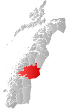
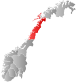
 Rana within Nordland |
|||
| Coordinates: 66°22′19″N 14°20′34″E / 66.37194°N 14.34278°ECoordinates: 66°22′19″N 14°20′34″E / 66.37194°N 14.34278°E | |||
| Country | Norway | ||
| County | Nordland | ||
| District | Helgeland | ||
| Administrative centre | Mo i Rana | ||
| Government | |||
| • Mayor (2011) | Kai Henning Henriksen (H) | ||
| Area | |||
| • Total | 4,460.75 km2 (1,722.31 sq mi) | ||
| • Land | 4,205.93 km2 (1,623.92 sq mi) | ||
| • Water | 254.82 km2 (98.39 sq mi) | ||
| Area rank | 4 in Norway | ||
| Population (2011) | |||
| • Total | 25,499 | ||
| • Rank | 32 in Norway | ||
| • Density | 6.1/km2 (16/sq mi) | ||
| • Change (10 years) | 0.5 % | ||
| Demonym(s) | Ranværing | ||
| Time zone | CET (UTC+1) | ||
| • Summer (DST) | CEST (UTC+2) | ||
| ISO 3166 code | NO-1833 | ||
| Official language form | Neutral | ||
| Website | www |
||
|
|
|||
| Nerdal/Rana (1961-90) | ||||||||||||||||||||||||||||||||||||||||||||||||||||||||||||
|---|---|---|---|---|---|---|---|---|---|---|---|---|---|---|---|---|---|---|---|---|---|---|---|---|---|---|---|---|---|---|---|---|---|---|---|---|---|---|---|---|---|---|---|---|---|---|---|---|---|---|---|---|---|---|---|---|---|---|---|---|
| Climate chart () | ||||||||||||||||||||||||||||||||||||||||||||||||||||||||||||
|
||||||||||||||||||||||||||||||||||||||||||||||||||||||||||||
|
||||||||||||||||||||||||||||||||||||||||||||||||||||||||||||
| J | F | M | A | M | J | J | A | S | O | N | D |
|
146
−3
−8
|
117
−2
−7
|
112
2
−4
|
74
5
−1
|
64
12
4
|
70
16
8
|
97
18
10
|
110
16
9
|
155
11
6
|
186
6
2
|
136
1
−4
|
163
−1
−6
|
| Average max. and min. temperatures in °C | |||||||||||
| Precipitation totals in mm | |||||||||||
| Source: met.no/klimastatistikk/eklima | |||||||||||
| Imperial conversion | |||||||||||
|---|---|---|---|---|---|---|---|---|---|---|---|
| J | F | M | A | M | J | J | A | S | O | N | D |
|
5.7
27
17
|
4.6
29
19
|
4.4
35
24
|
2.9
42
30
|
2.5
53
38
|
2.8
61
46
|
3.8
64
51
|
4.3
62
49
|
6.1
52
42
|
7.3
Wikipedia
...
| ||


