Ramsey, MN
| Ramsey | |
|---|---|
| City | |
| Ramsey, Minnesota | |

Ramsey Municipal Center, June 2009
|
|
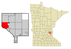
 Location of the city of Ramsey within Anoka County, Minnesota |
|
| Coordinates: 45°15′39″N 93°26′33″W / 45.26083°N 93.44250°WCoordinates: 45°15′39″N 93°26′33″W / 45.26083°N 93.44250°W | |
| Country | United States |
| State | Minnesota |
| County | Anoka |
| Government | |
| • Mayor | Sarah Strommen |
| Area | |
| • Total | 29.79 sq mi (77.16 km2) |
| • Land | 28.81 sq mi (74.62 km2) |
| • Water | 0.98 sq mi (2.54 km2) |
| Elevation | 879 ft (268 m) |
| Population (2010) | |
| • Total | 23,668 |
| • Estimate (2016) | 26,206 |
| • Density | 790/sq mi (310/km2) |
| Time zone | Central (CST) (UTC-6) |
| • Summer (DST) | CDT (UTC-5) |
| ZIP code | 55303 |
| Area code(s) | 763 |
| FIPS code | 27-53026 |
| GNIS feature ID | 0659677 |
| Website | City of Ramsey |
Ramsey is a city in Anoka County, Minnesota, United States. The population was 23,668 at the 2010 census. It is a northern suburb of the Twin Cities.
U.S. Highways 10 / 169 (co-signed) and State Highway 47 are two of the main routes, and a station on the Northstar Commuter Rail line to downtown Minneapolis is located in Ramsey.
Ramsey was named for Alexander Ramsey, first Territorial Governor of Minnesota.
According to the United States Census Bureau, the city has a total area of 29.79 square miles (77.16 km2), of which, 28.81 square miles (74.62 km2) is land and 0.98 square miles (2.54 km2) is water. Ramsey borders the cities of Anoka, Nowthen, Oak Grove, Dayton, and Elk River.
As of the census of 2010, there were 23,668 people, 8,033 households, and 6,484 families residing in the city. The population density was 821.5 inhabitants per square mile (317.2/km2). There were 8,302 housing units at an average density of 288.2 per square mile (111.3/km2). The racial makeup of the city was 91.8% White, 2.8% African American, 0.4% Native American, 2.4% Asian, 0.8% from other races, and 1.7% from two or more races. Hispanic or Latino of any race were 2.4% of the population.
...
Wikipedia
