Rambouillet
| Rambouillet | ||
|---|---|---|

Château of Rambouillet
|
||
|
||
| Coordinates: 48°38′40″N 1°49′51″E / 48.6444°N 01.8308°ECoordinates: 48°38′40″N 1°49′51″E / 48.6444°N 01.8308°E | ||
| Country | France | |
| Region | Île-de-France | |
| Department | Yvelines | |
| Arrondissement | Rambouillet | |
| Canton | Rambouillet | |
| Intercommunality | Plaines et Forêts d'Yveline | |
| Government | ||
| • Mayor (2014–2020) | Marc Robert | |
| Area1 | 35.19 km2 (13.59 sq mi) | |
| Population (2006)2 | 26,454 | |
| • Density | 750/km2 (1,900/sq mi) | |
| Time zone | CET (UTC+1) | |
| • Summer (DST) | CEST (UTC+2) | |
| INSEE/Postal code | 78517 / 78120 | |
| Elevation | 142–177 m (466–581 ft) (avg. 142 m or 466 ft) |
|
|
1 French Land Register data, which excludes lakes, ponds, glaciers > 1 km² (0.386 sq mi or 247 acres) and river estuaries. 2Population without double counting: residents of multiple communes (e.g., students and military personnel) only counted once. |
||
1 French Land Register data, which excludes lakes, ponds, glaciers > 1 km² (0.386 sq mi or 247 acres) and river estuaries.
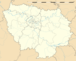
Rambouillet (IPA: [ʁɑ̃bujɛ]) is a commune in the Yvelines department in the Île-de-France in north-central France. It is located on the outskirts of Paris, 44.3 km (27.5 mi) southwest from the centre. Rambouillet is a sub-prefecture of the department.
Rambouillet lies on the edge of the vast Forest of Rambouillet (Forêt de Rambouillet or Forêt de l'Yveline), and is famous for its historical castle, the Château de Rambouillet, which hosted several international summits. Due to its proximity to Paris and Versailles, Rambouillet has long been an occasional seat of government.
Rambouillet is served by the SNCF Rambouillet railway station on the Transilien Paris – Montparnasse suburban rail line to Chartres.
Schools in the commune include:
Private schools include:
Universities:
Rambouillet is twinned with:
...
Wikipedia


