Ralls County, Missouri
| Ralls County, Missouri | |
|---|---|

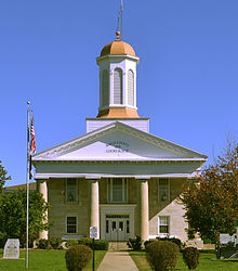
Ralls County Courthouse in New London
|
|
 Location in the U.S. state of Missouri |
|
 Missouri's location in the U.S. |
|
| Founded | November 16, 1820 |
| Named for | Daniel Ralls |
| Seat | New London |
| Largest city | Monroe City |
| Area | |
| • Total | 484 sq mi (1,254 km2) |
| • Land | 470 sq mi (1,217 km2) |
| • Water | 14 sq mi (36 km2), 2.65% |
| Population (est.) | |
| • (2015) | 10,196 |
| • Density | 22/sq mi (8/km²) |
| Congressional district | 6th |
| Time zone | Central: UTC-6/-5 |
| Website | www |
| Ralls County, Missouri | ||||
|---|---|---|---|---|
| Elected countywide officials | ||||
| Assessor | Josh Ketsenburg | Democratic | ||
| Circuit Clerk | Gina Jameson | Democratic | ||
| County Clerk | Sandra Lanier | Democratic | ||
| Collector | Connie L. Berry | Democratic | ||
|
Commissioner (Presiding) |
Wiley Hibbard | Democratic | ||
|
Commissioner (District 1) |
R.C. Harlow | Democratic | ||
|
Commissioner (District 2) |
John W. Lake | Republican | ||
| Coroner | Robert VanWinkle | Republican | ||
| Prosecuting Attorney | Rodney J. Rodenbaugh | Democratic | ||
| Public Administrator | Paula Evans | Democratic | ||
| Recorder | Gina Jameson | Democratic | ||
| Sheriff | Gerry Dinwiddie | Republican | ||
| Surveyor | Marty Wasson | Democratic | ||
| Treasurer | Jena L. Epperson | Democratic | ||
| Ralls County, Missouri | ||
|---|---|---|
| 2008 Republican primary in Missouri | ||
| John McCain | 256 (27.00%) | |
| Mike Huckabee | 376 (39.66%) | |
| Mitt Romney | 279 (29.43%) | |
| Ron Paul | 24 (2.53%) | |
| Ralls County, Missouri | ||
|---|---|---|
| 2008 Democratic primary in Missouri | ||
| Hillary Clinton | 823 (57.84%) | |
| Barack Obama | 504 (35.42%) | |
| John Edwards (withdrawn) | 78 (5.48%) | |
| Uncommitted | 11 (0.77%) | |
Ralls County is a county located in the northeastern portion of the U.S. state of Missouri. As of the 2010 census, the population was 10,167. Its county seat is New London. The county was organized November 16, 1820 and named for Daniel Ralls, Missouri state legislator.
Ralls County is part of the Hannibal, MO Micropolitan Statistical Area, which is also included in the Quincy-Hannibal, IL-MO Combined Statistical Area.
Ralls County was one of several along the Mississippi River settled by migrants from the Upper South, especially Kentucky and Tennessee. They brought slaves and slaveholding traditions with them, and quickly started cultivating crops similar to those in Middle Tennessee and Kentucky: hemp and tobacco. They also brought characteristic antebellum architecture and culture. Ralls was considered at the heart of what was called Little Dixie.
According to the U.S. Census Bureau, the county has a total area of 484 square miles (1,250 km2), of which 470 square miles (1,200 km2) is land and 14 square miles (36 km2) (2.9%) is water.
As of the census of 2010, there were 10,167 people, 3,736 households, and 2,783 families residing in the county. The population density was 20 people per square mile (8/km²). There were 4,564 housing units at an average density of 10 per square mile (4/km²). The racial makeup of the county was 97.93% White, 1.11% Black or African American, 0.20% Native American, 0.08% Asian, 0.01% Pacific Islander, 0.04% from other races, and 0.62% from two or more races. Approximately 0.44% of the population were Hispanic or Latino of any race. 30.1% were of American, 27.3% German, 10.5% English and 10.4% Irish ancestry.
...
Wikipedia
