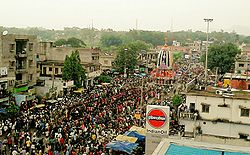
Rairangpur
|
Rairangpur ରାଇରଂଗପୁର |
|
|---|---|
| city | |
 |
|
| Nickname(s): Hill city of Odisha | |
| Location in Odisha, India | |
| Coordinates: 22°16′N 86°10′E / 22.27°N 86.17°ECoordinates: 22°16′N 86°10′E / 22.27°N 86.17°E | |
| Country |
|
| State | Odisha |
| District | Mayurbhanj |
| Government | |
| • Body | Municipality |
| • Chairperson | Mrs. Sailabala Mohanta (BJP) |
| Elevation | 248 m (814 ft) |
| Population (2011) | |
| • Total | 47,300 |
| Demonym(s) | Rairangpurians |
| Languages | |
| • Official | Odia |
| Time zone | IST (UTC+5:30) |
| PIN | 757 043 |
| Telephone code | 06794 |
| Vehicle registration | ORM-XXXX / OR 11-X-XXXX / OD 11-XXXX |
| Website | odisha |
Rairangpur ![]() pronunciation is a city and a Municipality in Mayurbhanj district in the state of Odisha, India. It is situated at about 85 kilometres from district headquarters of Baripada and about 80 km away from Jamshedpur(TataNagar).
pronunciation is a city and a Municipality in Mayurbhanj district in the state of Odisha, India. It is situated at about 85 kilometres from district headquarters of Baripada and about 80 km away from Jamshedpur(TataNagar).
The Khadkhai (Sulaipat) Dam is a local attraction nearby and Simlipal National Park is in the approachable distance attracting many foreign tourists.
This is a notable mining area of Odisha. Gorumahisani, Badampahar, Sulaipat are rich iron-ore mines of this place.
Rairangpur is located at 22°16′N 86°10′E / 22.27°N 86.17°E. It has an average elevation of 248 m (814 ft).
According to the 2011 Indian census, Rairangpur had a population of 47,294. Males constitute 52% of the population and females 48%. Rairangpur has an average literacy rate of 72%, higher than the national average of 59.5%: male literacy is 79%, and female literacy is 65%. In Rairangpur, 12% of the population is under 6 years of age.
Rairangpur acts as a liaison centre between Jamshedpur (Tatanagar) in Jharkhand, Durgapur in West Bengal and the Iron Ore Mines in Gorumahisani, Badampahar and Suleipat. The steel factories of Tata and the surrounding area rely partly on the iron ores extracted from these mines. In addition to freight trains there is also a passenger train from Jamshedpur to Badampahar via Rairangpur.
...
Wikipedia


