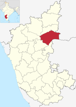
Raichur District
|
Raichur district ರಾಯಚೂರು ಜಿಲ್ಲೆ |
|
|---|---|
| District | |

|
|
 |
|
| Coordinates: 16°13′N 77°21′E / 16.21°N 77.35°ECoordinates: 16°13′N 77°21′E / 16.21°N 77.35°E | |
| Country |
|
| State | Karnataka |
| Division | Gulbarga Division |
| Headquarters | Raichur |
| Talukas | Raichur, Sindhanur, Lingsugur, Manvi, Devadurga |
| Government | |
| • District collector | S Sasikanth Senthil , IAS |
| Area† | |
| • Total | 8,386 km2 (3,238 sq mi) |
| Elevation | 400.0 m (1,312.3 ft) |
| Population (2001) | |
| • Total | 1,669,762 |
| • Density | 200/km2 (520/sq mi) |
| Languages | |
| • Official | Kannada |
| Time zone | IST (UTC+5:30) |
| PIN | 584101,584102,584103 |
| Telephone code | 08532 |
| ISO 3166 code | IN-KA-RA |
| Vehicle registration | KA-36 |
| Sex ratio | 0.983 ♂/♀ |
| Literacy | 48.8% |
| Lok Sabha constituency | Raichur Lok Sabha constituency |
| Precipitation | 680.6 millimetres (26.80 in) |
| Website | raichur |
| †Raichur district at a glance | |
Raichur District is an administrative district in the Indian state of Karnataka. It is located in the northeast part of the state and is bounded by Yadgir district in the north, Bijapur and Bagalkot district in the northwest, Koppal district in the west, Bellary district in the south, Mahabubnagar district of Telangana and Kurnool district of Andhra Pradesh in the east.
The district is bounded by the Krishna River on the north and the Tungabhadra River on the south. The wedge of land between the rivers is known as the Raichur Doab, after the city of Raichur. Bijapur and Gulbarga districts lie to the north across the Krishna River. Bagalkot and Koppal districts lie to the west. Across the Tungabhadra lies Bellary District of Karnataka to the southwest and Mahabubnagar of Telangana to the southeast. Kurnool District of Andhra Pradesh state lies to the east, and includes the lower portion of the Raichur-584 102...
The recorded history of the district is traced to as far back as the third century B.C. The fact that three minor rock edicts of Ashoka are found in this district one at Maski in the Lingasugur taluk and the other two near Koppal, prove that this area was included in the dominions of the great Mauryan king Ashoka (273 - 236 B.C.). At that time, this region was under the governance of the Viceroy or Mahamatra of Ashoka. Early in the Christian era, the district appears to have been a part of the kingdom of the Satavahanas. The Vakatakas, who reigned during the 3rd and 4th centuries A.D., seem to have held sway over Raichur for sometime, after which it appears to have been included in the Kadamba dominions. The next dynasty of importance, which ruled over this region, was that of the Chalukyas of Badami. According to an inscription from Aihole, Pulakeshin II having defeated the Pallavas, occupied this area and made it a province in his empire under the governance of his son Adityavarma. Later the whole of the present Raichur district was included in the dominions of the Rashtrakutas, who rose to power in the eighth century, as could be gathered from the inscriptions of that period found in this district. According to an inscription from Manvi taluk, one Jagattunga, a subordinate ruler under the Rashtrakuta king Krishna-II, was ruling the province of Adedore Eradusavirapranta, i.e., the area constituting the present Raichur district. Nripatunga, a Rashtrakuta king, has described Koppal in his Kannada work, Kavirajamarga, as the great Kopananagara.
...
Wikipedia
