Radyr Weir
Radyr
|
|
|---|---|
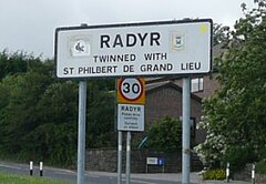
 Radyr street sign |
|
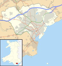
| Radyr shown within Cardiff | |
| OS grid reference | ST1380 |
| Community |
|
| Principal area | |
| Ceremonial county | |
| Country | Wales |
| Sovereign state | United Kingdom |
| Post town | Cardiff |
| Postcode district | CF15 |
| Dialling code | 029 |
| Police | South Wales |
| Fire | South Wales |
| Ambulance | Welsh |
| EU Parliament | Wales |
| UK Parliament | |
| Welsh Assembly | |
Radyr (Welsh: Radur) is an outer suburb of Cardiff, about 4 miles (6.4 km) northwest of Cardiff city centre. Radyr is part of Radyr and Morganstown Community, for which the 2011 Census recorded a population of 6,417.
Morganstown is north of Radyr, on the other side of the M4 Motorway. Neighbouring communities are Whitchurch to the east on the opposite bank of the River Taff, Pentyrch to the west with St Fagans and Llandaff to the south.
Evidence of Stone Age occupation of the Lesser Garth Cave near Morganstown was discovered in 1912 and included worked flints. In 1916 excavation of a mound of 30 metres (100 ft) in Radyr Woods revealed charcoal and Iron Age pottery. Radyr developed after the Norman invasion of Wales at the start of the 12th century and formed part of the Welsh Lordship or cantref of Miskin under the Lordship of Glamorgan created by the Norman King, William Rufus, in 1093.
Hints about the derivation of the name Radyr can be found in Lifris's writings Life of St Cadog, written between 1081 and 1104 but relating to the earlier period around AD 530, which mentions a croft or tref on the site called Aradur Hen. Lifris also tells the story of Tylyway, a religious hermit who was held to have lived on the banks of the Taff. Tylyway's cell is the most likely origin of the name Radyr; from the Welsh yr adur, meaning "the chantry", although Arudur Hen is also possible.
...
Wikipedia

