Whitchurch, Cardiff
Whitchurch
|
|
|---|---|
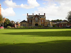
 Whitchurch Hospital |
|
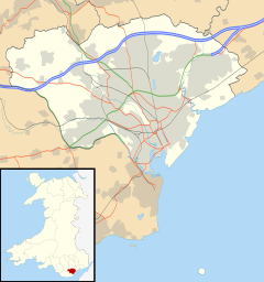
| Whitchurch shown within Cardiff | |
| Population | 16,138 (ward 2011) |
| Community |
|
| Principal area | |
| Ceremonial county | |
| Country | Wales |
| Sovereign state | United Kingdom |
| Post town | CARDIFF |
| Postcode district | CF14 |
| Dialling code | 029 |
| Police | South Wales |
| Fire | South Wales |
| Ambulance | Welsh |
| EU Parliament | Wales |
| UK Parliament | |
| Welsh Assembly | |
Whitchurch (Welsh: Yr Eglwys Newydd; eglwys church + newydd new) is a suburb and community in the north of Cardiff, capital of Wales. It is approximately 3 miles north of the centre of the city on the A470 road and A4054 road. Its estimated population as of 2004 was 15,649. It falls within the Whitchurch & Tongwynlais ward.
Whitchurch draws its name from White Church. The first mention of the area was in 1126 when the land was granted to Llandaff Cathedral and a chapel was built where Old Church Road now stands. It remained a dependency of the cathedral until 1845 when it became a separate parish.
After much resistance to the Norman conquest of England, the area succumbed to the Normans in 1266 who created the manor of Whitchurch which included Llandaff North and Rhiwbina, and who built Castell Coch to protect the approach to Cardiff in Tongwynlais. The castle became a ruin by the 16th century, possibly attacked by Owain Glyndŵr.
Until the early 18th century there were no more than around 300 people living in about 50 farms and cottages in Whitchurch, but by the end of the 19th century, this had risen to nearly 5,000.
An education report of 1847 reported that 8% of Whitchurch's children attended school. In 1854, the area's first national school was built, charging 2d a week. Whitchurch High School opened in 1937.
In the 19th century, the Bute family assumed responsibility of Whitchurch Common. Their attempt to produce wine on the slopes below Castell Coch was short-lived, bottling 40 gallons in 1887.
...
Wikipedia

