Radway
| Radway | |
|---|---|
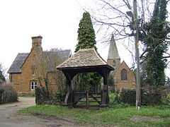
 St Peter's parish church and Lychgate |
|
| Radway shown within Warwickshire | |
| Population | 259 (2001 census) |
| OS grid reference | SP3748 |
| Civil parish |
|
| District | |
| Shire county | |
| Region | |
| Country | England |
| Sovereign state | United Kingdom |
| Post town | Warwick |
| Postcode district | CV35 |
| Dialling code | 01295 |
| Police | Warwickshire |
| Fire | Warwickshire |
| Ambulance | West Midlands |
| EU Parliament | West Midlands |
| UK Parliament | |
Radway is a village and civil parish in Warwickshire about 7 miles (11 km) north-west of Banbury in neighbouring Oxfordshire. The population taken at the 2011 census had reduced to 238.
The village is at the foot of Edge Hill and is notable for the Battle of Edgehill, one of the early major engagements of the English Civil War, which was fought in fields around the village and in the adjoining parishes of Ratley and Kineton.
The earliest known record of Radway is in the Domesday Book of 1086. In medieval times its lands were divided between Arbury Priory and Stoneleigh Abbey.
After the Dissolution of the Monasteries under Henry VIII in the 1530s the lands of Radway were granted to various of Henry's circle, notably the Coke family. As the lands were sold over the following years, the manorial system of Radway broke down.
Radway became a centre of Puritanism during and after the Commonwealth period. Persecution of Radway's Quakers and the jailing of some led eventually to a small group emigrating in the 1680s to a Quaker colony in Gloucester County, West New Jersey. Letters from New Jersey still survive in the local record office.
...
Wikipedia

