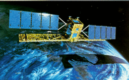
Radarsat-1

RADARSAT-1
|
|
| Mission type | Earth observation |
|---|---|
| Operator | CSA |
| COSPAR ID | 1995-059A |
| SATCAT № | 23710 |
| Website | www |
| Mission duration | Planned: 5 years Final: 17 years, 4 months, 24 days |
| Spacecraft properties | |
| Manufacturer |
MDA (formerly Spar) Ball Aerospace |
| Launch mass | 2,750 kilograms (6,060 lb) |
| Power | 2,100 watts |
| Start of mission | |
| Launch date | 4 November 1995, 14:22 UTC |
| Rocket | Delta II 7920-10 |
| Launch site | Vandenberg SLC-2W |
| Contractor | Boeing |
| End of mission | |
| Last contact | 29 March 2013 |
| Orbital parameters | |
| Reference system | Geocentric |
| Perigee | 793 kilometres (493 mi) |
| Apogee | 821 kilometres (510 mi) |
| Inclination | 98.6 degrees |
| Period | 100.70 minutes |
| Main radar | |
| Wavelengths | C band |
RADARSAT-1 is Canada's first commercial Earth observation satellite. It utilized synthetic aperture radar (SAR) to obtain images of the Earth's surface to manage natural resources and monitor global climate change. As of March 2013, the satellite was declared non-operational and is no longer collecting data.
RADARSAT-1 was launched at 14:22 UTC on 4 November, 1995, from Vandenberg AFB in California, into a sun-synchronous orbit (dawn-dusk) above the Earth with an altitude of 798 kilometres (496 mi) and inclination of 98.6 degrees. Developed under the management of the Canadian Space Agency (CSA) in co-operation with Canadian provincial governments and the private sector, it provided images of the Earth for both scientific and marketing purposes. Radarsat-1's images are useful in many fields, including agriculture, cartography, hydrology, forestry, oceanography, geology, ice and ocean monitoring, arctic surveillance, and detecting ocean oil slicks.
National Aeronautics and Space Administration (NASA) provided the Delta II rocket to launch RADARSAT-1 in exchange for access to its data. Estimates are that the project, excluding launch, cost $620 million (Canadian). The Canadian federal government contributed about $500 million, the four participating provinces (Quebec, Ontario, Saskatchewan and British Columbia) about $57 million, and the private sector about $63 million.
RADARSAT International, Inc. (RSI), a Canadian private company, was created in 1989 to process, market and distribute RADARSAT-1 data. (RADARSAT International, Inc. (RSI) was later acquired by MacDonald Dettwiler and Associates.) In 2006, RSI was rebranded MDA Geospatial Services International or MDA GSI.
RADARSAT-1 used a synthetic aperture radar (SAR) sensor to image the Earth at a single microwave frequency of 5.3 GHz, in the C band (wavelength of 5.6 cm). The SAR support structure was designed and manufactured by Northrop Grumman Astro Aerospace and deployed to 15 metres (49 ft) in length on orbit. Unlike optical satellites that sense reflected sunlight, SAR systems transmitted microwave energy towards the surface and recorded the reflections. Thus, Radarsat-1 imaged the Earth, day or night, in any atmospheric condition, such as cloud cover, rain, snow, dust or haze.
...
Wikipedia
