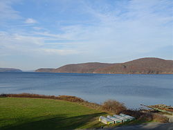
Quabbin Reservoir
| Quabbin Reservoir | |
|---|---|

November 2005
|
|
| Location | Massachusetts |
| Coordinates | 42°21′33″N 72°18′00″W / 42.35917°N 72.30000°WCoordinates: 42°21′33″N 72°18′00″W / 42.35917°N 72.30000°W |
| Lake type | Reservoir |
| Primary inflows | New Hampshire |
| Primary outflows | Atlantic ocean |
| Basin countries | United States |
| Max. length | 18 miles (28.9 km) |
| Surface area | 38.6 mi² (99.97 km²) |
| Average depth | 51 ft (16 m) |
| Max. depth | 150 ft (46 m) |
| Water volume | 412,000,000,000 US gal (1.56 km3) |
| Shore length1 | 181 mi (291 km) |
| Surface elevation | 522 ft (159 m) |
| Settlements | Belchertown Petersham Hardwick Ware New Salem Shutesbury |
| 1 Shore length is not a well-defined measure. | |
The Quabbin Reservoir is the largest inland body of water in the Commonwealth of Massachusetts and was built between 1930 and 1939. Today along with the Wachusett Reservoir, it is the primary water supply for Boston, some 65 miles (105 km) to the east, as well as 40 other communities in Greater Boston. It also supplies water to three towns west of the reservoir and acts as backup supply for three others. It has an aggregate capacity of 412 billion US gallons (1,560 GL) and an area of 38.6 square miles (99.9 km²).
Quabbin Reservoir water flows to the Wachusett Reservoir using the Quabbin Aqueduct. The Quabbin watershed is managed by the Massachusetts Department of Conservation and Recreation, while the water supply system is operated by the Massachusetts Water Resources Authority. The Winsor Dam and the Goodnough Dike form the reservoir from impoundments of the three branches of the Swift River. The Quabbin Reservoir is part of the Chicopee River Watershed, which in turn feeds the Connecticut River.
The Quabbin Spillway (which follows part of Quabbin Hill Road in Belchertown), allows water to bypass the Winsor Dam and join the Swift River when the reservoir is full.
In 1947, the Massachusetts Legislature authorized the construction of the Chicopee Valley Aqueduct to deliver Quabbin water to three communities in Western Massachusetts: Chicopee, South Hadley, and Wilbraham. In 1951, with the Quabbin-Wachusett system sufficient to meet foreseeable needs, the Cochituate Aqueduct was abandoned, and the Framingham Reservoir system was placed on emergency stand-by. The present Lake Cochituate is the so-called Framingham Reservoir and now serves as a major swimming and boating resource but is no longer part of the potable water supply.
...
Wikipedia
