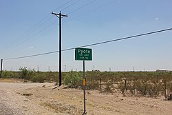
Pyote, Texas
| Pyote, Texas | |
|---|---|
| Town | |
 |
|
 TXMap-doton-Pyote.PNG |
|
| Coordinates: 31°32′15″N 103°7′36″W / 31.53750°N 103.12667°WCoordinates: 31°32′15″N 103°7′36″W / 31.53750°N 103.12667°W | |
| Country | United States |
| State | Texas |
| County | Ward |
| Area | |
| • Total | 1.3 sq mi (3.3 km2) |
| • Land | 1.3 sq mi (3.3 km2) |
| • Water | 0.0 sq mi (0.0 km2) |
| Elevation | 2,625 ft (800 m) |
| Population (2010) | |
| • Total | 114 |
| • Density | 88/sq mi (35/km2) |
| Time zone | Central (CST) (UTC-6) |
| • Summer (DST) | CDT (UTC-5) |
| ZIP code | 79777 |
| Area code(s) | 432 |
| FIPS code | 48-59996 |
| GNIS feature ID | 1365876 |
Pyote (/ˈpaɪ.oʊt/ PYE-oat) is a town in Ward County, Texas, United States. The population was 114 at the 2010 census.
Pyote began as a small town. Its fortunes rose with oil, but its population decreased when the railroad was built away from the town. At one time Pyote had 3,500 residents. The 1942 development of the Pyote Army Air Base and the 1967 development of what would become the West Texas State School raised the town's fortunes.
Pyote is located at 31°32′15″N 103°7′36″W / 31.53750°N 103.12667°W (31.537478, -103.126771).
According to the United States Census Bureau, the town has a total area of 1.3 square miles (3.3 km²), all land.
This area has a large amount of sunshine year round due to its stable descending air and high pressure. According to the Köppen Climate Classification system, Pyote has a mild desert climate, abbreviated "Bwh" on climate maps.
...
Wikipedia
