Prince George County, Virginia
| Prince George County, Virginia | ||
|---|---|---|

Prince George County Courthouse
|
||
|
||
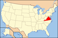
 Location in the U.S. state of Virginia |
||
 Virginia's location in the U.S. |
||
| Founded | 1703 | |
| Named for | Prince George of Denmark | |
| Seat | Prince George | |
| Largest community | Fort Lee | |
| Area | ||
| • Total | 282 sq mi (730 km2) | |
| • Land | 265 sq mi (686 km2) | |
| • Water | 17 sq mi (44 km2), 5.9% | |
| Population (est.) | ||
| • (2015) | 37,862 | |
| • Density | 124/sq mi (48/km²) | |
| Congressional districts | 3rd, 4th | |
| Time zone | Eastern: UTC-5/-4 | |
| Website | www |
|
Prince George County is a county located in the Commonwealth of Virginia. As of the 2010 census, the population was 35,725. Its county seat is Prince George.
Prince George County is in Tri-Cities area of the Greater Richmond Region. When settled during the colonial era, this area was known as Southside, believed to attract entrepreneurial men who were not from families as established as those who first settled along the James River.
Prince George County was formed in 1703 in the Virginia Colony from the portion of Charles City County that was south of the James River. It was named in honor of Prince George of Denmark, husband of Anne, Queen of Great Britain.
In 1619, "Charles Cittie" [sic] was one of four "boroughs" or "incorporations" created by the Virginia Company. The first Charles City County courthouses were located along the James River at Westover Plantation on the north side and City Point on the south side. The Virginia Company lost its charter in 1624, and Virginia became a royal colony. Charles City Shire was formed in 1634 in the Virginia Colony by order of Charles I, King of England. It was named as Charles City County in 1643.
...
Wikipedia

