Preston, Connecticut
| Preston, Connecticut | ||
|---|---|---|
| Town | ||
|
||
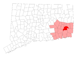
 Location in New London County, Connecticut |
||
| Coordinates: 41°31′N 72°0′W / 41.517°N 72.000°WCoordinates: 41°31′N 72°0′W / 41.517°N 72.000°W | ||
| Country | United States | |
| State | Connecticut | |
| NECTA | Norwich-New London | |
| Region | Southeastern Connecticut | |
| Incorporated | 1687 | |
| Government | ||
| • Type | Selectman-town meeting | |
| • First selectman | Robert M. Congdon (R) | |
| • Selectman | Michael Sinko (R) | |
| • Selectman | Lynwood Crary (D) | |
| Area | ||
| • Total | 31.8 sq mi (82.4 km2) | |
| • Land | 30.9 sq mi (80.0 km2) | |
| • Water | 0.9 sq mi (2.2 km2) | |
| Elevation | 177 ft (54 m) | |
| Population (2010) | ||
| • Total | 4,726 | |
| • Density | 150/sq mi (57/km2) | |
| Time zone | Eastern (UTC-5) | |
| • Summer (DST) | Eastern (UTC-4) | |
| ZIP code | 06365 | |
| Area code(s) | 860 | |
| FIPS code | 09-62150 | |
| GNIS feature ID | 0213492 | |
| Website | www |
|
Preston is a town in New London County, Connecticut, United States. The population was 4,726 at the 2010 census. The town includes the villages of Long Society, Preston City, and Poquetanuck.
In 1686, Thomas Parke, Thomas Tracy, and several others petitioned for and were granted by the Connecticut General Court authority to establish a plantation seven miles square to the east of Norwich and north of New London and Stonington. Owaneco, son of the Mohegan sachem Uncas, gave a confirmatory deed for the land in 1687. In October of that same year, the town was formally incorporated as Preston, named for the English city of Preston, Lancashire.
The Ecclesiastical Society of Preston was first organized in 1698, with the first meetinghouse located in present-day Preston City. At the request of residents in the northern part of Preston (now the town of Griswold), the North Society was established in 1716. A splinter group, the Separate Church of Preston, was established in 1747 and continued until 1817. The Preston City Baptist Church (now the Preston City Bible Church) was established in 1812.
On August 4, 1954, an Air France Lockheed L-1049C Super Constellation flying from Orly Airport to Idlewild Airport crashed near Preston.
According to the United States Census Bureau, the town has a total area of 31.8 square miles (82 km2), of which 30.9 square miles (80 km2) is land and 0.9 square miles (2.3 km2), or 2.71%, is water.
...
Wikipedia

