Powis Street
 |
|
| Maintained by | Greenwich London Borough Council |
|---|---|
| Location | Woolwich, south east London |
| Postal code | SE18 |
| Nearest metro station |
Woolwich Arsenal |
| Coordinates | 51°29′28″N 0°04′09″E / 51.491111°N 0.069167°E |
| west end | John Wilson Street, or Woolwich High Street, or |
| east end | Green's End, Beresford Square |
| Construction | |
| Construction start | 1782 (road), 1798 (built environment) |
| Completion | 1821 |
| Other | |
| Known for |
Royal Arsenal Co-operative Society buildings, Granada Cinema, Woolwich |
| Status | Partly pedestrianised shopping street |
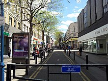
Powis Street is a partly pedestrianised shopping street in Woolwich in the Royal Borough of Greenwich, south east London, England. It was laid out in the late 18th century and was named after the Powis brothers, who developed most of the land in this part of the town. The street has been rebuilt several times but has retained some notable examples of late-Victorian and Art Deco architecture.
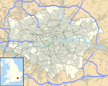
Powis Street is situated in central Woolwich, to the south of, and more or less parallel to the main thoroughfare, the A206 dual carriageway, locally known as Woolwich High Street and Beresford Street. The western end of the street meets the South Circular Road (A205) at Parson's Hill. At its eastern end are the town's two main squares, Beresford Square and General Gordon Square. This is also where Woolwich Arsenal railway and DLR stations are situated and where the future Crossrail station is being built. Since the pedestrianisation of the street, busses are only allowed to pass through a small section of the street but there are many busstops in the vicinity, mostly around the stations. A large multi-storey carpark exists in Monk Street / Calderwood Street. Other car parks are available at the west end of Powis Street and in Macbean Street.
In the late 18th century, the military and naval town of Woolwich was situated along the High Street, and to the north of that street along the banks of the river Thames, crammed in between Woolwich Dockyard and The Warren (later the Royal Arsenal). Most shops would have been along the High Street, where the market was based. This area is now Old Woolwich where little remains from its long history. The area that is now the commercial heart of Woolwich was still largely rural, with a small cluster of cottages around Green's End and the New Road. To the north and east of the future Powis Street was the Royal Ropeyard and some gardens; to the south and west lay virgin land. As the town was growing rapidly - from 6,500 in 1720 to almost 17,000 in 1811 - the need arose for a new town centre and the obvious location was the area south of the ropeyard, between the old town and the Arsenal's entrance.
...
Wikipedia

