Beresford Square

Beresford Square with market stalls, Royal Arsenal Gatehouse and Crossrail towers
|
|
| Maintained by | Greenwich London Borough Council |
|---|---|
| Location | Woolwich, South East London |
| Postal code | SE18 |
| Nearest train station |
|
| Coordinates | 51°29′28″N 0°04′09″E / 51.491111°N 0.069167°E |
| Construction | |
| Inauguration | 1813 |
| Other | |
| Known for | Woolwich Market Royal Arsenal Gatehouse |
Beresford Square is a pedestrianised town and market square in Woolwich in the Royal Borough of Greenwich in London, England. It was formed in the early 19th century and was named after the Anglo-Irish general William Beresford, Master-General of the Ordnance and Governor of the Royal Military Academy in Woolwich. With its lively street market and lined with shops, pubs and restaurants, Beresford Square has been the heart of Woolwich for over two centuries.
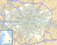
Beresford Square is situated in central Woolwich, between the town's shopping district and the Royal Arsenal, from which it is separated by the busy A206 road. The western section of this road is called Beresford Street, the eastern section Plumstead Road. The square is largely pedestrianised. To the east lies Woolwich New Road, accessible only for busses. Most of the bus stops are on Woolwich New Road or General Gordon Square, around Woolwich Arsenal station. Beresford square is situated close to the railway and DLR stations, as well as the future Crossrail station, more or less in between the four station buildings.
Beresford Square is not a laid-out square but the result of a series of clearances. Therefore, some of the buildings are older than the square. In 1812-13, some "paltry buildings" around the road junction near the main entrance to the Arsenal were demolished for "encroachment on Crown land". The northern section of the road that wound down from Woolwich Common to Plumstead Road was called Green's End. The northernmost tip, now the west side of Beresford Square, was known as the High Pavement. Land to the east of this road was part of the Burrage Estate, named after its 14th-century owner, Bartholomew de Burghersh. The Salutation Inn stood almost at the northern end of the High Pavement. It had a tea garden and may have been Woolwich's first theater, mentioned in 1721. The garden later became Salutation Alley with about 20 timber cottages. In one of these Henry Maudslay was born in 1771. Living conditions here were appalling, as described in the Booth Survey of 1900. It was condemned a slum in 1955 and cleared in the 1960s and 70s and is now a market traders' pound. In 1833 the Salutation pub moved to new premises next door. In 1831 four more cottages were cleared on the southeast side of the square, creating more space between the two pubs on this end, the Ordnance Arms and the Elephant & Castle. Along with several pubs on Plumstead Road and the New Road, these all thrived with thousands of Arsenal workers passing through the area every day.
...
Wikipedia

