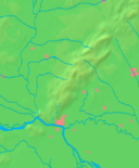
Poszony
| Bratislava | |||
| Capital city | |||
|
Bratislava Montage. Clockwise from top left: View of Bratislava from the castle, St. Michael's Gate in the Old Town, Eurovea shopping complex, Primate's Palace, Hviezdoslav Square, Bratislava castle and the Danube riverbank at night
|
|||
|
|||
| Nickname: Beauty on the Danube, Little Big City | |||
| Country | Slovakia | ||
|---|---|---|---|
| Region | Bratislava | ||
| Districts | Bratislava I, II, III, IV, V | ||
| Landmark | Bratislava Castle | ||
| Rivers | Danube, Morava, Little Danube | ||
| Elevation | 134 m (440 ft) | ||
| Coordinates | 48°08′38″N 17°06′35″E / 48.14389°N 17.10972°ECoordinates: 48°08′38″N 17°06′35″E / 48.14389°N 17.10972°E | ||
| Highest point | Devínska Kobyla | ||
| - elevation | 514 m (1,686 ft) | ||
| Lowest point | Danube River | ||
| - elevation | 126 m (413 ft) | ||
| Area | 367.584 km2 (142 sq mi) | ||
| - urban | 853.15 km2 (329 sq mi) | ||
| - metro | 2,053 km2 (793 sq mi) | ||
| Population | 421,801 (2016) | ||
| - urban | 583,600 | ||
| - metro | 659,578 | ||
| Density | 1,147/km2 (2,971/sq mi) | ||
| First mentioned | 907 | ||
| Government | City council | ||
| Mayor | Ivo Nesrovnal | ||
| Timezone | CET (UTC+1) | ||
| - summer (DST) | CEST (UTC+2) | ||
| Postal code | 8XX XX | ||
| Phone prefix | 421 2 | ||
| Car plate | BA, BL | ||
| Statistics: ŠÚ SR | |||
| Website: bratislava.sk, bratislava-slovakia.eu | |||
| Bratislava | ||||||||||||||||||||||||||||||||||||||||||||||||||||||||||||
|---|---|---|---|---|---|---|---|---|---|---|---|---|---|---|---|---|---|---|---|---|---|---|---|---|---|---|---|---|---|---|---|---|---|---|---|---|---|---|---|---|---|---|---|---|---|---|---|---|---|---|---|---|---|---|---|---|---|---|---|---|
| Climate chart () | ||||||||||||||||||||||||||||||||||||||||||||||||||||||||||||
|
||||||||||||||||||||||||||||||||||||||||||||||||||||||||||||
|
||||||||||||||||||||||||||||||||||||||||||||||||||||||||||||
| J | F | M | A | M | J | J | A | S | O | N | D |
|
39
3
−4
|
37
5
−2
|
38
10
1
|
34
17
5
|
55
22
10
|
57
25
13
|
53
28
15
|
59
27
15
|
55
22
11
|
38
16
6
|
54
8
2
|
46
3
−2
|
| Average max. and min. temperatures in °C | |||||||||||
| Precipitation totals in mm | |||||||||||
| Source: Pogodaiklimat.ru | |||||||||||
| Imperial conversion | |||||||||||
|---|---|---|---|---|---|---|---|---|---|---|---|
| J | F | M | A | M | J | J | A | S | O | N | D |
|
1.5
37
25
|
1.5
41
28
|
1.5
...
| |||||||||


