Portland, New York
| Portland, New York | |
|---|---|
| Town | |
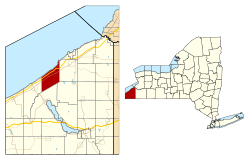
 Location within Chautauqua County and New York |
|
| Location within the state of New York | |
| Coordinates: 42°22′58″N 79°27′43″W / 42.38278°N 79.46194°WCoordinates: 42°22′58″N 79°27′43″W / 42.38278°N 79.46194°W | |
| Country | United States |
| State | New York |
| County | Chautauqua |
| Government | |
| • Type | Town Council |
| • Town Supervisor | Daniel F. Schrantz (D) |
| • Town Council |
Members' List
|
| Area | |
| • Total | 34.2 sq mi (88.5 km2) |
| • Land | 34.1 sq mi (88.4 km2) |
| • Water | 0.08 sq mi (0.2 km2) |
| Elevation | 784 ft (239 m) |
| Population (2010) | |
| • Total | 4,827 |
| • Density | 141/sq mi (54.6/km2) |
| Time zone | Eastern (EST) (UTC-5) |
| • Summer (DST) | EDT (UTC-4) |
| ZIP code | 14769 |
| Area code(s) | 716 |
| FIPS code | 36-59421 |
| GNIS feature ID | 0979388 |
| Website | townofportland |
Portland is a town in Chautauqua County, New York, United States. The population was 4,827 at the 2010 census. The town is on the shore of Lake Erie southwest of Dunkirk.
The area was first settled in 1804. The town of Portland was founded in 1813 from the town of Chautauqua. Subsequently, the town was reduced in size to form two new towns: Ripley (1816) and Westfield (1829).
A genealogical history of Portland was published in 1873 by Dr. H. C. Taylor, titled Historical Sketches of the Town of Portland, New York. An all names index was created for this book by Agnes Lee Mitchell in 1989 and published by the Chautauqua County Genealogical Society.
According to the United States Census Bureau, the town has a total area of 34.18 square miles (88.53 km2), of which 34.12 square miles (88.36 km2) is land and 0.07 square miles (0.17 km2), or 0.19%, is water.
The New York State Thruway (Interstate 90) and US 20 cross the northern part of the town. NY 5 parallels the shore of Lake Erie.
The Lakeview Shock Incarceration Correctional Facility is within Portland, and their residents are therefore counted in the following demographics.
As of the census of 2000, there were 5,502 people, 1,655 households, and 1,161 families residing in the town. The population density was 160.6 people per square mile (62.0/km²). There were 2,096 housing units at an average density of 61.2 per square mile (23.6/km²). The racial makeup of the town was 82.93% White, 12.05% African American, 0.49% Native American, 0.02% Asian, 0.02% Pacific Islander, 3.51% from other races, and 0.98% from two or more races. Hispanic or Latino of any race were 8.62% of the population.
...
Wikipedia

