Pont Champlain
|
Champlain Bridge French: pont Champlain |
|
|---|---|
 |
|
| Coordinates | 45°28′07″N 73°31′03″W / 45.46861°N 73.51750°WCoordinates: 45°28′07″N 73°31′03″W / 45.46861°N 73.51750°W |
| Carries | Autoroute 10, 15, 20 |
| Crosses |
St. Lawrence River and Saint Lawrence Seaway |
| Locale | Brossard and Montreal, Quebec, Canada |
| Owner | The Jacques Cartier and Champlain Bridges Inc. |
| Maintained by | The Jacques Cartier and Champlain Bridges Inc. |
| Website | pontchamplainbridge |
| Characteristics | |
| Design | Steel truss Cantilever bridge |
| Material | Steel, Concrete |
| Total length | 3,440 m (11,286 ft) 7,412 m (24,318 ft) (including approaches) |
| Longest span | 215.5 m (707.02 ft) |
| Clearance below | 36.6 m (120 ft) at mid-span |
| No. of lanes | 6 |
| History | |
| Designer |
Philip Louis Pratley Henry Hugh Lewis Pratley |
| Engineering design by | Philippe Ewart Lalonde and Valois |
| Constructed by | Atlas Construction Company Limited McNamara (Quebec) Limited The Key Construction Inc. Deschamps & Bélanger Limitée Dominion Bridge Company |
| Construction begin | 1957 |
| Construction cost |
C$35 million C$52 million (including approaches and Bonaventure Expressway) |
| Opened | June 28, 1962 |
| Statistics | |
| Daily traffic | 159,000 |
| Toll | Collected until 1990 |
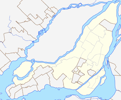
The Champlain Bridge (French: Pont Champlain) is a steel truss cantilever bridge with approach viaducts constructed of prestressed concrete beams supporting a prestressed concrete deck paved with asphalt. The bridge crosses the Saint Lawrence River and Saint Lawrence Seaway, connecting the Montreal boroughs of Verdun and Le Sud-Ouest to Brossard on the South Shore.
The bridge, with approaches, is approximately 6 km (3.7 mi) long. When the project began, it was designated as the "Nuns' Island Bridge" because it crosses over Nuns' Island. In 1958, it was officially named the Champlain Bridge in honour of the explorer Samuel de Champlain, who founded Quebec City in 1608.
Together with the Jacques Cartier Bridge, it is administered by the Jacques Cartier and Champlain Bridges Incorporated (JCCBI), a Canadian Crown Corporation which reports to Infrastructure Canada.
The bridge sees about 50 million crossings per year of which are 200,000 buses. On an average weekday, 66% of users are commuters. It is one of the busiest single-span bridges in Canada.
The concrete structure has been degraded by the use of de-icing salt, requiring expensive mitigation. In 2016 construction began on a replacement bridge designed to handle higher volumes of traffic.
The Champlain Bridge project was undertaken in 1955 and construction proceeded between 1957 and 1962. The bridge carries six lanes of vehicle traffic; three in each direction. During rush hour one lane of those heading off the island in the morning, and onto the island in the evening, is used as a reserved bus lane for buses to be able to head in the opposite direction. The bridge was opened to traffic in stages as the approaches were completed between June, 1962 and September, 1964. It was subsequently connected to the Bonaventure Expressway, which is part of the north approach to the bridge. The expressway was opened to traffic on April 21, 1967. Approximately 49 million vehicles and 196 million people cross the Champlain Bridge annually, making it one of the busiest bridges in the world.
...
Wikipedia

