Pomme de Terre River (Minnesota)
| Pomme de Terre River | |
| River | |
|
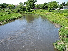
The Pomme de Terre River in Appleton in 2007
|
|
| Country | United States |
|---|---|
| State | Minnesota |
| Source | Stalker Lake |
| - location | Tordenskjold Township, Otter Tail County |
| - elevation | 1,283 ft (391 m) |
| - coordinates | 46°11′55″N 95°51′20″W / 46.19861°N 95.85556°W |
| Mouth | Minnesota River |
| - location | Appleton Township, Swift County |
| - elevation | 935 ft (285 m) |
| - coordinates | 45°10′33″N 96°05′13″W / 45.17583°N 96.08694°WCoordinates: 45°10′33″N 96°05′13″W / 45.17583°N 96.08694°W |
| Length | 124.5 mi (200 km) |
| Basin | 875 sq mi (2,266 km2) |
| Discharge | for Appleton |
| - average | 132 cu ft/s (4 m3/s) |
| - max | 8,890 cu ft/s (252 m3/s) |
| - min | 0 cu ft/s (0 m3/s) |
The Pomme de Terre River is a 125-mile-long (201 km)tributary of the Minnesota River in western Minnesota in the United States. Via the Minnesota River, it is part of the watershed of the Mississippi River, draining an area of 875 square miles (2,270 km2) in an agricultural region. The headwaters region of the Pomme de Terre River is the northernmost extremity of the Minnesota River's watershed.
The name Pomme de Terre is French and means literally "soil apple," usually meaning "potato." In this case, the river was named by early French explorers for a different root vegetable, the potato-like prairie turnip (Psoralea esculenta), which was commonly eaten by the Sioux.
The Pomme de Terre River issues from Stalker Lake in Tordenskjold Township, approximately three miles (5 km) northeast of Dalton in southern Otter Tail County, and flows generally southwardly through eastern Grant and Stevens Counties and western Swift County, through the cities of Barrett, Morris, and Appleton. It flows into Marsh Lake on the Minnesota River in southwestern Swift County, approximately four miles (6 km) southwest of Appleton. Marsh Lake was formed by a backup of water caused by the Pomme de Terre's delta, and is presently maintained by a manmade dam.
...
Wikipedia


