Pomfret, Vermont
| Pomfret, Vermont | |
|---|---|
| Town | |

Abbott Memorial Library in South Pomfret
|
|
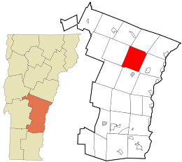
 Location in Windsor County and the state of Vermont. |
|
| Location in the United States | |
| Coordinates: 43°41′51″N 72°31′13″W / 43.69750°N 72.52028°WCoordinates: 43°41′51″N 72°31′13″W / 43.69750°N 72.52028°W | |
| Country | United States |
| State | Vermont |
| County | Windsor |
| Area | |
| • Total | 39.5 sq mi (102.2 km2) |
| • Land | 39.4 sq mi (102.0 km2) |
| • Water | 0.1 sq mi (0.2 km2) |
| Elevation | 1,499 ft (457 m) |
| Population (2010) | |
| • Total | 904 |
| • Density | 23/sq mi (8.8/km2) |
| Time zone | Eastern (EST) (UTC-5) |
| • Summer (DST) | EDT (UTC-4) |
| ZIP code | 05053, 05067 |
| Area code(s) | 802 |
| FIPS code | 50-56350 |
| GNIS feature ID | 1462177 |
| Website | pomfretvt |
Pomfret is a town in Windsor County, Vermont, United States. The population was 904 at the 2010 census.
The town was named after the Earl of Pomfret. Pomfret was chartered in 1761 by Benning Wentworth, who was the governor of New Hampshire. The first settler (1770) was Bartholomew Durkee, who came from Pomfret, Connecticut. Pomfret was called "New Pomfret" at first because most of the people who settled there came from the town in Connecticut.
One of the earliest ski tows in the United States was established at South Pomfret in 1934, and became known as Suicide Six.
In 1976, then-cardinal Karol Wojtyla visited North Pomfret during the summer for a vacation. He later became Pope John Paul II and was canonized a saint.
According to the United States Census Bureau, the town has a total area of 39.5 square miles (102.2 km2), of which 39.4 square miles (102.0 km2) is land and 0.1 square mile (0.2 km2) (0.15%) is water. The Ottauquechee River flows along a portion of the southern boundary of the town. The Pomfret town hall is located in the center of town, on the watershed divide between the White River (North Pomfret) and the Ottauquechee River (South Pomfret).
As of the census of 2000, there were 997 people, 404 households, and 288 families residing in the town. The population density was 25.3 people per square mile (9.8/km2). There were 544 housing units at an average density of 13.8 per square mile (5.3/km2). The racial makeup of the town was 98.09% White, 0.10% African American, 0.50% Asian, 0.40% Pacific Islander, and 0.90% from two or more races. Hispanic or Latino of any race were 1.40% of the population.
...
Wikipedia

