Pocono Mountains Municipal Airport
| Pocono Mountains Municipal Airport | |||||||||||||||
|---|---|---|---|---|---|---|---|---|---|---|---|---|---|---|---|
| Summary | |||||||||||||||
| Airport type | Public | ||||||||||||||
| Owner | Pocono Mountains Municipal Airport Authority | ||||||||||||||
| Serves | Mount Pocono, Pennsylvania | ||||||||||||||
| Elevation AMSL | 1,915 ft / 584 m | ||||||||||||||
| Coordinates | 41°08′16″N 075°22′48″W / 41.13778°N 75.38000°WCoordinates: 41°08′16″N 075°22′48″W / 41.13778°N 75.38000°W | ||||||||||||||
| Website | www.MPOairport.com | ||||||||||||||
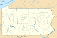
| Map | |||||||||||||||
| Location of airport in Pennsylvania | |||||||||||||||
| Runways | |||||||||||||||
|
|||||||||||||||
| Statistics (2011) | |||||||||||||||
|
|||||||||||||||
|
Source: Federal Aviation Administration
|
|||||||||||||||
| Aircraft operations | 19,850 |
|---|---|
| Based aircraft | 19 |
Pocono Mountains Municipal Airport (IATA: MPO, ICAO: KMPO, FAA LID: MPO) is a public airport two miles northwest of Mount Pocono, in Monroe County, Pennsylvania. It is owned by the Pocono Mountains Municipal Airport Authority. The National Plan of Integrated Airport Systems for 2011–2015 categorized it as a general aviation facility.
The airport covers 275 acres (111 ha) at an elevation of 1,915 feet (584 m). It has two asphalt runways: 5/23 is 4,000 by 100 feet (1,219 x 30 m) and 13/31 is 5,001 by 75 feet (1,524 x 23 m).
In the year ending August 31, 2011 the airport had 19,850 aircraft operations, average 54 per day: 98.5% general aviation and 1.5% military. 19 aircraft were then based at the airport: 79% single-engine, 10.5% multi-engine, and 10.5% helicopter.
...
Wikipedia

