Plomelin
|
Plomelin Ploveilh |
||
|---|---|---|

Town hall
|
||
|
||
| Coordinates: 47°56′11″N 4°09′06″W / 47.9364°N 4.1517°WCoordinates: 47°56′11″N 4°09′06″W / 47.9364°N 4.1517°W | ||
| Country | France | |
| Region | Brittany | |
| Department | Finistère | |
| Arrondissement | Quimper | |
| Canton | Quimper-3 | |
| Intercommunality | Quimper-Communauté | |
| Government | ||
| • Mayor (2014–2020) | Jean-Paul Le Dantec | |
| Area1 | 26.08 km2 (10.07 sq mi) | |
| Population (2008)2 | 4,080 | |
| • Density | 160/km2 (410/sq mi) | |
| Time zone | CET (UTC+1) | |
| • Summer (DST) | CEST (UTC+2) | |
| INSEE/Postal code | 29170 /29700 | |
| Elevation | 0–88 m (0–289 ft) | |
|
1 French Land Register data, which excludes lakes, ponds, glaciers > 1 km² (0.386 sq mi or 247 acres) and river estuaries. 2Population without double counting: residents of multiple communes (e.g., students and military personnel) only counted once. |
||
1 French Land Register data, which excludes lakes, ponds, glaciers > 1 km² (0.386 sq mi or 247 acres) and river estuaries.
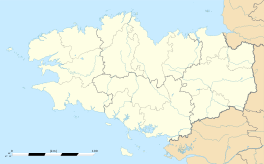
Plomelin (Ploveilh in Breton) is a commune in the Finistère department of Brittany in north-western France.
It lies near the Odet river, about 7 km (4.3 mi) southwest of Quimper.
Plomelin is twinned with the village of Crymych in Wales. Plomelin is twinned with the village of Betziesdorf in Germany.
Inhabitants of Plomelin are called in French Plomelinois.
The municipality launched a linguistic plan through Ya d'ar brezhoneg on July 3, 2008.
...
Wikipedia


