Plainwell, Michigan
| Plainwell, Michigan | |
|---|---|
| City | |
| Nickname(s): The Island City | |
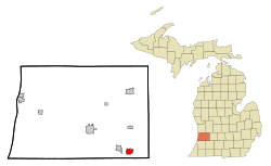
 Location of Plainwell, Michigan |
|
| Coordinates: 42°26′36″N 85°38′34″W / 42.44333°N 85.64278°W | |
| Country | United States |
| State | Michigan |
| County | Allegan |
| Government | |
| • Mayor | Rick Brooks |
| Area | |
| • Total | 2.06 sq mi (5.34 km2) |
| • Land | 1.98 sq mi (5.13 km2) |
| • Water | 0.08 sq mi (0.21 km2) |
| Elevation | 728 ft (222 m) |
| Population (2010) | |
| • Total | 3,804 |
| • Estimate (2012) | 3,799 |
| • Density | 1,921.2/sq mi (741.8/km2) |
| Time zone | Eastern (EST) (UTC-5) |
| • Summer (DST) | EDT (UTC-4) |
| ZIP code | 49080 |
| Area code(s) | 269 |
| FIPS code | 26-64740 |
| GNIS feature ID | 0635077 |
Plainwell is a city in Allegan County in the U.S. state of Michigan. The population was 3,804 at the 2010 census.
Plainwell is located on M-89 just east of its junction with US 131. The city of Otsego is about three miles (5 km) to the west. Kalamazoo is about ten miles (16 km) to the south and Grand Rapids about 35 miles (56 km) north. The Kalamazoo River flows through the center of the city.
Plainwell is the birthplace of syndicated cartoonist Dave Coverly, creator of the Speed Bump comic strip, actor Ed Gale[1][2], famous for his role as Howard the Duck in the movie of the same name.
Though it sounds somewhat common, there are no other communities named Plainwell anywhere in the United States. It is known as The Island City.
This part of Michigan was settled in the 1830s, after the removal of native people. Allegan County was organized in 1835, and the Plainwell area was settled soon after. It was on a stagecoach route from Kalamazoo to Grand Rapids, and later the Grand Rapids and Indiana Railroad was constructed along the same route. After the advent of the automobile, U.S. Route 131 was created and run through the town. In the 1960s, an improved 4-lane US-131 was built west of town to connect Kalamazoo and Grand Rapids, with an interchange on M-89 between Plainwell and Otsego. This allowed the town to become a kind of "bedroom community" for Kalamazoo or the southern part of Grand Rapids.
According to the United States Census Bureau, the city has a total area of 2.06 square miles (5.34 km2), of which 1.98 square miles (5.13 km2) is land and 0.08 square miles (0.21 km2) is water. The nickname Island City has to do with a power canal which diverts a portion of the Kalamazoo River around the downtown area, causing it to be an island.
...
Wikipedia
