Pittsford (village), New York
| Pittsford | |
| Village | |
| Country | United States |
|---|---|
| State | New York |
| County | Monroe |
| Township | Pittsford |
| Elevation | 492 ft (150.0 m) |
| Coordinates | 43°05′20″N 77°30′54″W / 43.08889°N 77.51500°WCoordinates: 43°05′20″N 77°30′54″W / 43.08889°N 77.51500°W |
| Area | 0.7 sq mi (1.8 km2) |
| - land | 0.7 sq mi (2 km2) |
| - water | 0.04 sq mi (0 km2), 5.71% |
| Population | 1,355 (2010) |
| Incorporated | 1827 |
| Mayor | Robert Corby (2007) |
| Timezone | EST (UTC-5) |
| - summer (DST) | EDT (UTC-4) |
| ZIP code | 14534 |
| Area code | 585 |
| FIPS code | 36-58354 |
| Demonym | Pittsfordian |
|
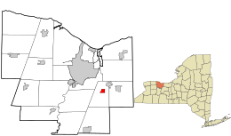
Location in Monroe County and the state of New York.
|
|
|
Location of New York in the United States
|
|
|
Website: villageofpittsford |
|
Pittsford is a village in Monroe County, New York, United States. The population was 1,355 at the 2010 census. It is named after Pittsford, Vermont, the native town of a founding father.
The Village of Pittsford is the oldest village in Monroe County, incorporated in 1827. The village, an Erie Canal community, is in the Town of Pittsford. Pittsford is an upscale suburb of Rochester.
Pittsford is located at 43°5′20″N 77°30′54″W / 43.08889°N 77.51500°W (43.089013, -77.515239).
According to the United States Census Bureau, the village has a total area of 0.7 square miles (1.8 km²), of which, 0.7 square miles (1.7 km²) of it is land and 0.04 square miles (0.1 km²) of it (4.35%) is water. Pittsford is located seven miles (11 km) southeast of Rochester in western New York State. The village is bisected by the historic Erie Canal.
Pittsford is the oldest of Monroe County's ten incorporated villages. The village was the site of a spring fed pond which attracted the first European Americans. Israel Stone, the village's first settler, built the village's first structure, a log house next to the pond, in 1789.
The town of Pittsford surrounding the village was established in 1789 and was originally named Northfield. Pittsford's original hamlet settlement was located a mile south of the current village. In the second decade of the nineteenth century the opening of a new east/west highway (now NYS Route 31) and the surveying of the proposed Erie Canal route caused settlement to migrate northward to the Four Corners area.
...
Wikipedia


