Pittsford, Vermont
| Pittsford, Vermont | |
|---|---|
| Town | |

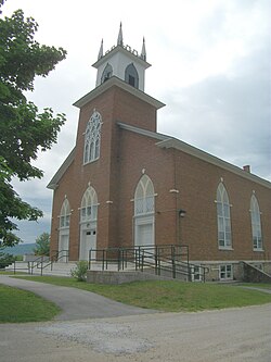
Pittsford Congregational Church
|
|
 Pittsford, Vermont |
|
| Coordinates: 43°42′N 73°1′W / 43.700°N 73.017°WCoordinates: 43°42′N 73°1′W / 43.700°N 73.017°W | |
| Country | United States |
| State | Vermont |
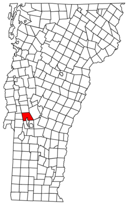
| County | Rutland |
| Area | |
| • Total | 43.6 sq mi (112.8 km2) |
| • Land | 43.5 sq mi (112.6 km2) |
| • Water | 0.1 sq mi (0.2 km2) |
| Elevation | 466 ft (142 m) |
| Population (2010) | |
| • Total | 2,991 |
| • Density | 69/sq mi (27/km2) |
| Time zone | Eastern (EST) (UTC-5) |
| • Summer (DST) | EDT (UTC-4) |
| ZIP code | 05763 |
| Area code(s) | 802 |
| FIPS code | 50-55600 |
| GNIS feature ID | 1462174 |
Pittsford is a town in Rutland County, Vermont, United States. As of the 2010 census, the town population was 2,991. Named for William Pitt, it has two picket forts used in the American Revolutionary War.
Pittsford was first settled as a frontier town in 1769, about 60 miles (97 km) north of Bennington. It is the location of two historical picket forts used by the militia during the American Revolutionary War: Fort Mott (built in 1777), and Fort Vengeance (built from 1780 to 1781), about a mile north.
The town of Pittsford, New York, was named by Colonel Caleb Hopkins after his hometown of Pittsford, Vermont, named after William Pitt.
Among the first settlers in Pittsford were the Cooley half-brothers, Benjamin Cooley III and Gideon Cooley. Gideon Cooley and Benjamin Cooley III were members of the Green Mountain Boys, and Benjamin was Captain under Col. Ethan Allen in the Revolutionary War and specifically the Capture of Fort Ticonderoga.
According to the United States Census Bureau, the town has a total area of 43.6 square miles (113 km2), of which 43.5 square miles (113 km2) is land and 0.1 square miles (0.26 km2), or 0.18%, is water.
...
Wikipedia
