Piedmont, Missouri
| Piedmont, Missouri | |
|---|---|
| City | |

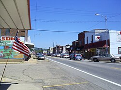
Streetside in Piedmont
|
|
 Location of Piedmont, Missouri |
|
| Coordinates: 37°9′14″N 90°41′45″W / 37.15389°N 90.69583°WCoordinates: 37°9′14″N 90°41′45″W / 37.15389°N 90.69583°W | |
| Country | United States |
| State | Missouri |
| County | Wayne |
| Government | |
| • Type | Mayor-Council |
| • Mayor | William H. "Bill" Kirkpatrick |
| Area | |
| • Total | 2.15 sq mi (5.57 km2) |
| • Land | 2.14 sq mi (5.54 km2) |
| • Water | 0.01 sq mi (0.03 km2) |
| Elevation | 495 ft (151 m) |
| Population (2010) | |
| • Total | 1,977 |
| • Estimate (2012) | 1,966 |
| • Density | 923.8/sq mi (356.7/km2) |
| Time zone | Central (CST) (UTC-6) |
| • Summer (DST) | CDT (UTC-5) |
| ZIP code | 63957 |
| Area code(s) | 573 |
| FIPS code | 29-57422 |
| GNIS feature ID | 0751576 |
| Website | City of Piedmont's Website |
Piedmont is a fourth-class city located in northwestern Wayne County in Southeast Missouri in the United States. The population was 1,977 at the 2010 census. A part of the Ozarks Foothills Region, Piedmont is located on the convergence of State Highways 34 and 49. Piedmont, transliterated as "foot of the mountain," is named for its geographic placement at the foot of Clark Mountain, a 1424-foot summit approximately two miles north of the town.
Piedmont was platted in 1871 when the railroad was extended to that point. The community derives its name from the French pied and mont, meaning "foot" and "mountain" respectively. A post office called Piedmont has been in operation since 1872.
Piedmont is located at 37°9′0″N 90°41′45″W / 37.15000°N 90.69583°W.
According to the United States Census Bureau, the city has a total area of 2.15 square miles (5.57 km2), of which, 2.14 square miles (5.54 km2) is land and 0.01 square miles (0.03 km2) is water.
Piedmont includes the neighborhood of Beckville.
As of the census of 2010, there were 1,977 people, 823 households, and 500 families residing in the city. The population density was 923.8 inhabitants per square mile (356.7/km2). There were 993 housing units at an average density of 464.0 per square mile (179.2/km2). The racial makeup of the city was 96.5% White, 0.5% African American, 0.3% Native American, 1.0% Asian, 0.8% from other races, and 1.1% from two or more races. Hispanic or Latino of any race were 1.4% of the population.
...
Wikipedia
