Phoenicia, New York
| Phoenicia | |
| CDP, hamlet | |
|
View east from NY 214 along Main Street
|
|
| Name origin: From Phoenix tannery | |
| Country | United States |
|---|---|
| State | New York |
| Region | Catskills |
| County | Ulster |
| Town | Shandaken |
| River | Esopus Creek |
| Elevation | 827 ft (252 m) |
| Coordinates | 42°4′53″N 74°18′47″W / 42.08139°N 74.31306°WCoordinates: 42°4′53″N 74°18′47″W / 42.08139°N 74.31306°W |
| Area | 0.5 sq mi (1 km2) |
| Population | 309 (2010) |
| Density | 823.2/sq mi (318/km2) |
| Timezone | Eastern (EST) (UTC-5) |
| - summer (DST) | EDT (UTC-4) |
| ZIP Code | 12464 |
| Area code | 845 |
| Exchange | 688 |
| FIPS code | 36-57650 |
| GNIS feature ID | 0960320 |
|
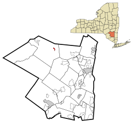
Location in Ulster County and the state of New York.
|
|
Phoenicia is a hamlet (and census-designated place) in Ulster County, New York, United States. The population was 309 at the 2010 census.
Phoenicia is located in the northeast part of Town of Shandaken, on Route 28. It is the largest community in the town. The village is located on Route 28, right at the junction with Route 214, and is next to Esopus Creek.
The railroad (the Ulster and Delaware Railroad) arrived at this community first, making it the first to develop the tourist industry which is still a major part of the local economy. Phoenicia is also the western terminus of the Catskill Mountain Railroad's tourist operations (which run on the former Ulster and Delaware tracks). Severe washouts west of Bridge Street prevent westward operations.
Since 2010 the town has been home to the Phoenicia International Festival of the Voice every August.
The Phoenicia Railroad Station was listed on the National Register of Historic Places in 1995.
Phoenicia is located at 42°4′53″N 74°18′47″W / 42.08139°N 74.31306°W (42.081266, -74.313019).
...
Wikipedia


