Pettigo
|
Pettigo Paiteagó
|
|
|---|---|
| Village | |

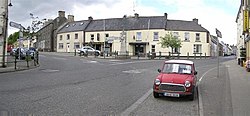
Pettigo village centre
|
|
| Location in Ireland | |
| Coordinates: 54°32′56″N 7°49′52″W / 54.549°N 7.831°WCoordinates: 54°32′56″N 7°49′52″W / 54.549°N 7.831°W | |
| Country | Ireland and United Kingdom |
| Province | Ulster |
| County |
County Donegal, County Fermanagh |
| Population (2006) | |
| • Urban | 424 |
| Time zone | WET (UTC+0) |
| • Summer (DST) | IST (WEST) (UTC-1) |
| Irish Grid Reference | H105669 |
Pettigo (also spelt Pettigoe; Irish: Paiteagó) is a small village on the border of County Donegal, Republic of Ireland and County Fermanagh, Northern Ireland. It is bisected by the Termon River which is part of the border between the Republic of Ireland and Northern Ireland. The portion of the village in Northern Ireland is officially called Tullyhommon, but is locally known as 'High Street' due to its hillside position overlooking the remainder of the village. The rest of the village in the Republic includes Main Street, Mill Street and Station Street, all of which meet in The Diamond at the centre of the village. There are also two relatively modern housing estates on the northern outskirts, namely Termon Villas and St. Patrick's Terrace along with new developments such as Mill Grove. Until the late 1700s, the area was known as 'An Tearmann', meaning 'a place of sanctuary'. The modern Irish (Paiteagó) and English (Pettigo) names derive from the Latin protectio (protection), a translation of the Irish 'An Tearmann'.
Once a thriving market village on the Enniskillen and Bundoran Railway, the village suffered from partition in 1922, the closure of the railway in 1957 and from the closure of numerous cross-border roads by the British Army at the height of the Troubles in Northern Ireland. The latter had the effect of cutting Pettigo off from much of its rural hinterland in counties Fermanagh and Tyrone. In recent years economic prospects have improved with the reopening of many of the cross-border roads, improving access for tourists and locals alike.
Agriculture, particularly the rearing of sheep and cattle, forms the mainstay of the local economy. The quality of the local land (marshy, with much blanket bog) renders it largely unsuitable for grain crops. There are also expansive forestry plantations in the surrounding townlands, owned and operated by Coillte Teoranta, the Republic's Forestry Service. Many of the plantations occupy land unsuitable for other commercial uses, or where peat extraction has been completed, leaving poor quality thin soil cover behind. The Sitka Spruce and Lodgepole Pine softwood varieties comprise 90% of the canopy.
...
Wikipedia

