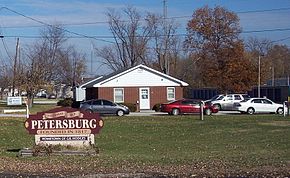
Petersburg, IN
| Petersburg, Indiana | |
|---|---|
| City | |
| City of Petersburg | |
 |
|
 Location of Petersburg in Pike County, Indiana. |
|
| Coordinates: 38°29′30″N 87°16′49″W / 38.49167°N 87.28028°WCoordinates: 38°29′30″N 87°16′49″W / 38.49167°N 87.28028°W | |
| Country | United States |
| State | Indiana |
| County | Pike |
| Township | Washington |
| Government | |
| • Mayor | R.C. Klipsch |
| • City Code Inspector | Kullen Cook |
| • City Services Manager | Brian Davis |
| • Clerk/Treasurer | Tammy Selby |
| Area | |
| • Total | 1.47 sq mi (3.81 km2) |
| • Land | 1.47 sq mi (3.80 km2) |
| • Water | 0.00 sq mi (0.01 km2) 0% |
| Elevation | 482 ft (147 m) |
| Population (2010) | |
| • Total | 2,383 |
| • Estimate (2016) | 2,331 |
| • Density | 1,590.04/sq mi (613.91/km2) |
| Time zone | EST (UTC-6) |
| • Summer (DST) | EDT (UTC-5) |
| ZIP code | 47567 |
| Area code(s) | 812 |
| FIPS code | 18-59364 |
| GNIS feature ID | 449709 |
| Interstate Highways | |
| Major State Roads |
|
| Website | http://www.petersburg.in.gov/ |
Petersburg is a city in Washington Township, Pike County, in the U.S. state of Indiana. The population was 2,383 at the 2010 census. The city is the county seat of Pike County.
Petersburg is part of the Jasper Micropolitan Statistical Area.
Petersburg was laid out in 1817. The city was named for Peter Brenton, an original owner of the town site. A post office has been in operation at Petersburg since 1823.
Petersburg is located at 38°29′30″N 87°16′49″W / 38.49167°N 87.28028°W (38.491653, -87.280372).
According to the 2010 census, Petersburg has a total area of 1.474 square miles (3.82 km2), of which 1.47 square miles (3.81 km2) (or 99.73%) is land and 0.004 square miles (0.01 km2) (or 0.27%) is water. The lower portion of the White River runs through the city.
The climate in this area is characterized by hot, humid summers and generally mild to cool winters. According to the Köppen Climate Classification system, Petersburg has a humid subtropical climate, abbreviated "Cfa" on climate maps.
As of the census of 2010, there were 2,383 people, 1,025 households, and 592 families residing in the city. The population density was 1,621.1 inhabitants per square mile (625.9/km2). There were 1,134 housing units at an average density of 771.4 per square mile (297.8/km2). The racial makeup of the city was 97.7% White, 0.5% African American, 0.3% Native American, 0.5% Asian, 0.2% from other races, and 0.8% from two or more races. Hispanic or Latino of any race were 0.9% of the population.
...
Wikipedia
