Perry, Ohio
| Perry, Ohio | |
|---|---|
| Village | |

The Lucius Green House, built 1880
|
|
| Motto: "Together We Take Pride" | |
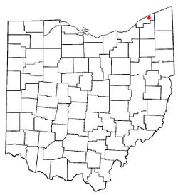
 Location of Perry, Ohio |
|
 Location of Perry in Lake County |
|
| Coordinates: 41°45′33″N 81°8′18″W / 41.75917°N 81.13833°WCoordinates: 41°45′33″N 81°8′18″W / 41.75917°N 81.13833°W | |
| Country | United States |
| State | Ohio |
| County | Lake |
| Area | |
| • Total | 2.18 sq mi (5.65 km2) |
| • Land | 2.18 sq mi (5.65 km2) |
| • Water | 0 sq mi (0 km2) |
| Elevation | 699 ft (213 m) |
| Population (2010) | |
| • Total | 1,663 |
| • Estimate (2012) | 1,659 |
| • Density | 762.8/sq mi (294.5/km2) |
| Time zone | Eastern (EST) (UTC-5) |
| • Summer (DST) | EDT (UTC-4) |
| ZIP code | 44081 |
| Area code(s) | 440 |
| FIPS code | 39-61882 |
| GNIS feature ID | 1044385 |
Perry is a village in Lake County, Ohio, United States. The population was 1,663 at the 2010 census. It is named in honor of Commodore Oliver Hazard Perry to commemorate his victory over the British fleet at the Battle of Lake Erie in September 1813. The battle was a turning point in the western theater during the War of 1812. Perry is known for its public schools, whose recent construction was influenced by the nearby Perry Nuclear Generating Station.
Perry has participated in the Tree City USA program since 1988.
Perry Village has an elected Mayor and Council form of government.
Perry is served by the Perry Public Schools.
In 2005, the Perry Public Library loaned more than 245,000 items to its 8,000 cardholders. Total holdings are over 52,000 volumes with over 275 periodical subscriptions.
Perry is located at 41°45′33″N 81°8′18″W / 41.75917°N 81.13833°W (41.759121, -81.138321).
According to the United States Census Bureau, the village has a total area of 2.18 square miles (5.65 km2), all land.
...
Wikipedia
