Peneda-Gerês National Park
| Peneda-Gerês National Park (Parque Nacional da Peneda-Gerês) | |
| National park (Parque Nacional) | |
|
A view of the yellowish landscape of the Serra Amarela (Yellow Serra)
|
|
| Official name: Parque Nacional da Peneda-Gerês | |
| Named for: the two extreme where the national park extends between Serra da Peneda and 'Serra do Gerês | |
| Nickname: Gerês, PNPG | |
| Country | |
|---|---|
| Region | Norte |
| Subregion | Alto Trás-os-Montes, Cávado, Minho-Lima |
| Districts | Braga, Viana do Castelo, Vila Real |
| Municipalities | Arcos de Valdevez, Melgaço, Montalegre, Ponte da Barca, Terras de Bouro |
| Rivers | Cávado, Lima, Minho |
| Location | Parque Nacional da Peneda-Gerês |
| - elevation | 381 m (1,250 ft) |
| - coordinates | 41°43′49.22″N 8°9′42.05″W / 41.7303389°N 8.1616806°WCoordinates: 41°43′49.22″N 8°9′42.05″W / 41.7303389°N 8.1616806°W |
| Highest point | Pico da Nevosa |
| - location | Serra do Gerês, Outeiro, Montalegre |
| - elevation | 1,559 m (5,115 ft) |
| - coordinates | 41°48′58.56″N 8°2′57.79″W / 41.8162667°N 8.0493861°W |
| Lowest point | Lima River |
| - elevation | 52 m (171 ft) |
| - coordinates | 41°48′55.23″N 8°20′0.75″W / 41.8153417°N 8.3335417°W |
| Length | 45.44 km (28 mi), Northwest-Southeast |
| Width | 45.34 km (28 mi), Southwest-Southeast |
| Area | 702.90 km2 (271 sq mi) |
| Biomes | Euro-Siberian, Mediterranean |
| Geology | Schist, Quartzites-Feldspar, Greywacke, Andalusite, Cordierite, Sillimanite |
| Orogeny | Varsican |
| Period | Silurian, Devonian, Permian |
| Founded | Decree Law 187/71 |
| Date | 8 May 1971 |
| Management | Parque National da Peneda-Gerês Headquarters |
| - location | Avenida António Macedo, Sé, Braga |
| - elevation | 163 m (535 ft) |
| - coordinates | 41°33′10.73″N 8°25′52.63″W / 41.5529806°N 8.4312861°W |
| Owner | Portuguese Republic |
| For public | Public |
| Easiest access | Lamas de Mouro (EN202); Mezio (EN202); Entre Ambos-os-Rios (EN203); Covide (EN307); Rio Caldo or Amares (EN308); Braga or Vieira do Minho (EN304); Fafião (EN103); Paradela (EN308-4); Sezelhe (EN308) |
|
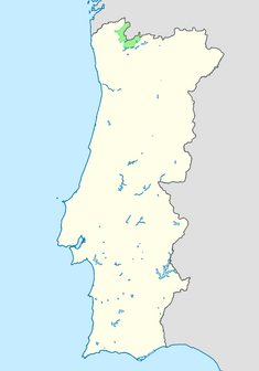
Location of the Peneda-Gerês National Park within continental Portugal
|
|
| Website: Parque Natural da Peneda-Gerês | |
The Peneda-Gerês National Park (Portuguese: Parque Nacional da Peneda-Gerês), also known simply as Gerês, is the only national park in Portugal (although many natural parks, protected landscapes, and reserves exist across the nation). It is located in the Norte region, in the northwest of Portugal, specifically in the districts of Viana do Castelo, Braga, and Vila Real.
The park was created on 8 May 1971 due to its national and international scientific interest, with the aim to protect the soil, water, flora, fauna, and landscape, while preserving its value to the existent human and natural resources. Education and tourism are also goals of the park.
Probably, because the Gerês mountains are an inhospitable place, the oldest signs of human presence date only from 6000 BC to 3000 BC; dolmens and other megalithic tombs remain interspersed within the region, including near Castro Laboreiro and Mourela. Human activities consisted of animal husbandry and incipient agriculture, and archaeological evidence points to the beginning of decrease in forest cover.
The Roman Geira, a Roman road, crosses the region, which formerly connected the Roman civitates of Asturgia and Braccara Augusta. Long stretches of the road, along the Homem River are still preserved, along with several Roman bridges and numerous millenarium markers. The Germanic tribe of the Buri accompanied the Suebi in their invasion of the Iberian Peninsula and establishment in Gallaecia (modern northern Portugal and Galicia). The Buri settled in the region between the Cávado and Homem Rivers, in the area later known as Terras de Bouro (Land of the Buri). The move from the terraced cliffs and slopes to the lowland river valleys brought-on a patterned of new deforestation.
...
Wikipedia


